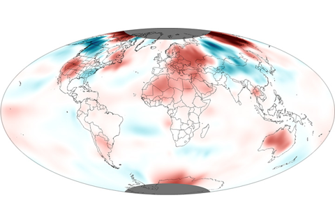
The average global temperature for November 2012 was the fifth warmest November since record keeping began in 1880.
The November nationally averaged precipitation total of 1.19 inches was nearly an inch below the long-term average, making this the eighth driest November on record.
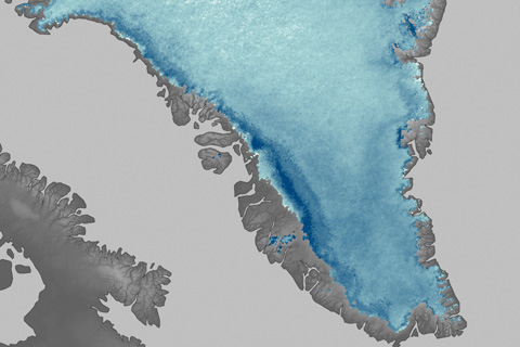
Melt ponds, snow loss, and other warming-induced changes are making the surface of the Greenland Ice Sheet far less reflective in the summer than it was even a decade ago. The darker ice surface absorbs more sunlight than it once did, accelerating warming and melting.
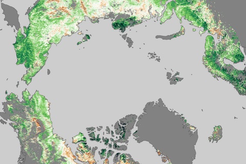
Few real-world signs of climate change are easier to read than changes in the growing season of familiar vegetation. Most of the high-latitudes of the Northern Hemisphere are experiencing longer growing seasons now than they did more than two and half decades ago.
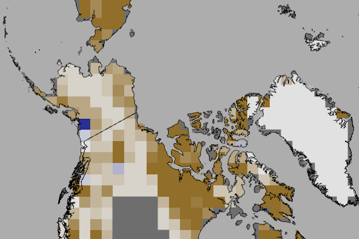
In June 2012, snow cover extent over Eurasia and North America hit a new record low. It is the third time in five years that North America has set a new record low, and the fifth year in a row that Eurasia has. The rate of snow cover loss over Northern Hemisphere land areas in June between 1979 and 2012 is -17.6% per decade—a faster decline than September sea ice loss over the same period.
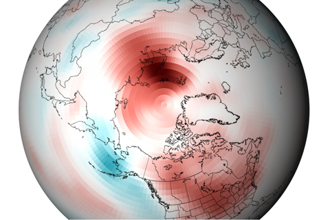
On a yearly basis, Arctic temperatures are strongly influenced by natural climate patterns, including the Arctic and North Atlantic Oscillations. Over the span of a decade, though, Arctic amplification of climate change is evident: no part of the Arctic was cooler than the long-term average.
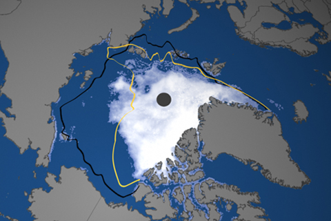
The 2012 Arctic sea ice extent was nearly 50 percent smaller than the long-term (1979-2000) average. For sea ice to have shrunk to half its historic summer extent is as much a transformation of the environment as if half the forests of New England had been replaced by cactus.
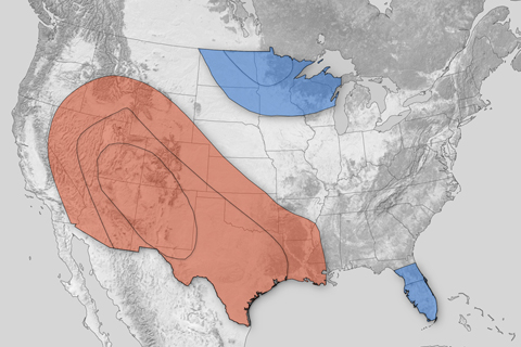
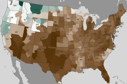
Much of the western and southern central United States could be in for a warmer-than-average winter this year, while the upper Midwest and Florida peninsula could experience colder-than-average temperatures. Most of California and western Nevada could experience well-below-normal precipitation, while parts of the southeast could receive well-above-normal precipitation.
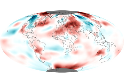
The average global temperature for October 2012 was the fifth warmest October since recordkeeping began in 1880.
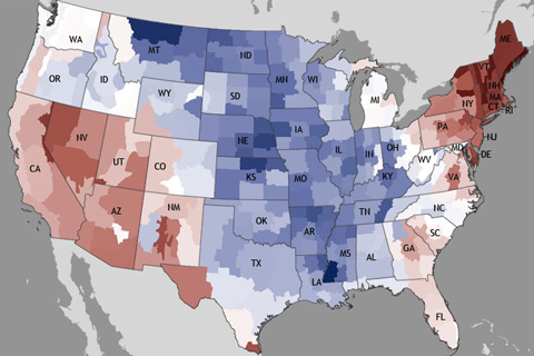
October 2012 ended the 16-month streak of above-average monthly temperatures for the contiguous United States, with an average temperature of 53.9° Fahrenheit, 0.3° Fahrenheit below the long-term average.