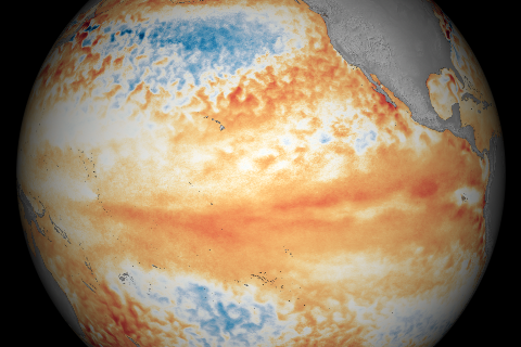
The global mean sea level in 2015 was approximately 7 centimeters (2.7 inches) above the 1993 average, making it the highest observed since the satellite altimeter record began in 1993. Regional variations highlighted the short-term influence of climate phenomena like the Pacific Decadal Oscillation and the largest El Niño event since 1997/98.

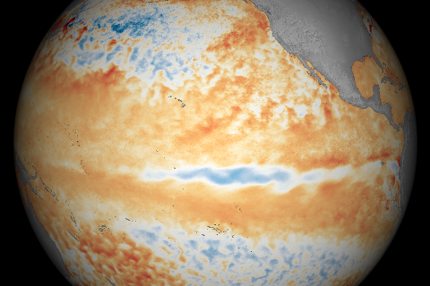
Long-term warming and a strong El Niño contributed to the highest annual combined temperature for ocean and land since reliable records began in the mid-to-late 1800s.

Record-setting warmth enveloped the contiguous United States in June 2016.
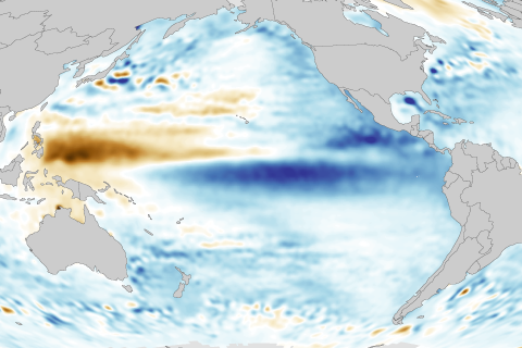
With El Niño in the rearview mirror, the central tropical Pacific continued to cool in June 2016.

This year's Atlantic hurricane outlook comes with relatively high uncertainty. One challenge: figuring out if the Atlantic Ocean climate pattern that favors active hurricane seasons has shifted gears.

A deep pool of cool water that had been lurking beneath the surface of the eastern tropical Pacific in April began to emerge at the surface in May 2016.
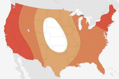
Most of the continental United States is facing elevated chances of well above average summer temperatures, according to the latest outlook from NOAA’s Climate Prediction Center.
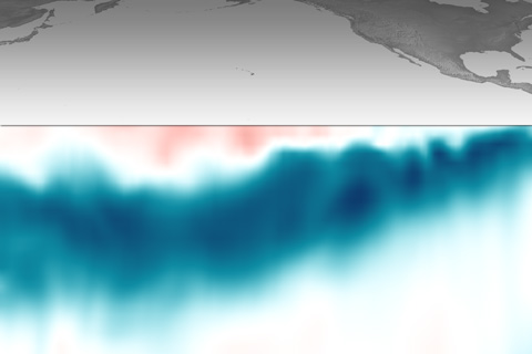
Beneath the surface of the tropical Pacific, a deep pool of cool water has been sliding slowly eastward. This massive, slow-motion wave is a favorable sign that La Niña might develop.
Compared to March, parts of the tropical Pacific showed signs of cooling off in April 2016.
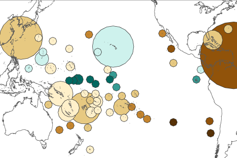
Based on rainfall changes alone, half of the island groups in a recent study were projected to get drier by the end of the century. When scientists also accounted for more evaporation due to rising temperatures, nearly three-quarters of the islands studied were projected to face freshwater stress.