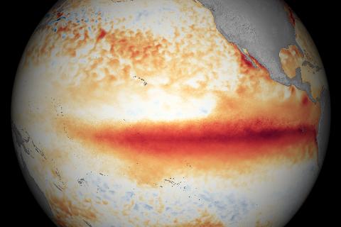
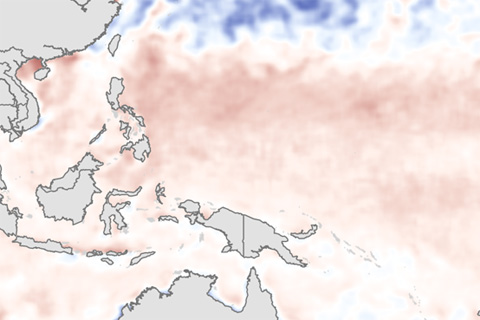
A strong El Niño continued during December 2015 with well above average sea surface temperatures across the central and eastern equatorial Pacific Ocean, according to NOAA Climate Prediction Center’s monthly El Niño advisory update.
Answers to some of the questions that readers frequently ask NOAA experts about El Niño and La Niña.
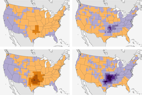
Scienitsts find connection between El Niño and fewer spring tornadoes in the south-central United States.
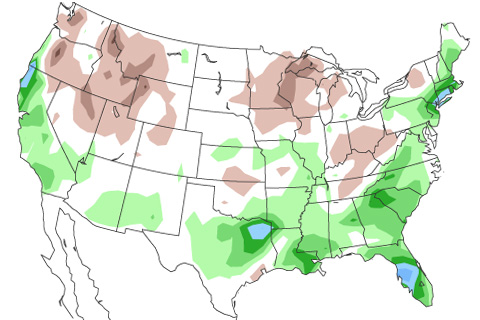
This pair of maps shows whether your state tends to have wet, dry, or average springs during El Niño, and how often the wet or dry pattern occurred during the last 10 El Niño years.
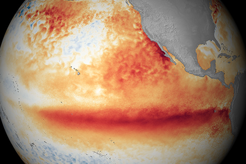
Through June, the eastern Pacific was warmer than average, but the lack of a strong gradient in sea surface temperature anomalies between the eastern and western Pacific may have kept the atmosphere from getting in sync with the developing El Niño.
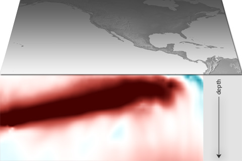
A pool of warm water lurking beneath the surface of the western Pacific has been slowly sloshing eastward in the past few months. This traveling wave of warm water is one of the signs that climate conditions are favorable for the emergence of El Niño later this year.
A new paper looked at 20 years work of real-time ENSO Model forecasts and found some interesting patterns. Did you know models found it pretty freaking hard to predict the onset of La Nina events?
A La Niña Watch has been issued by NOAA's Climate Prediction Center. But also, we are still in El Niño! Confused? Let the ENSO bloggers explain.
With an analogy drawn from the gym, Michelle L'Heureux explains (again!) how weather (your workout) is not climate (your fitness).
The September 2023 ENSO Outlook predicts El Niño will stick around at least through January-March 2024. But don't just take it from us, hear directly from the Pacific Ocean and tropical atmosphere, who join the blog to answer some questions.