Unseasonable cold in the Rockies, Northern Plains, and Great Lakes were balanced by much warmer than average conditions in the Southwest and Southeast coastal states.
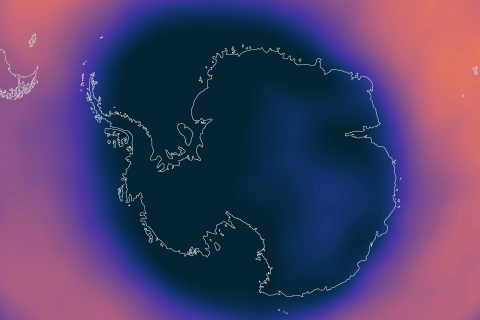
A strong polar vortex supported the formation of a large and deep Antarctic ozone hole in September 2020 that should persist into November, NOAA and NASA scientists reported today.
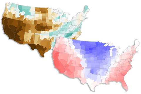
The soaking brought to the Gulf region by tropical cyclones in September 2020 contrasted starkly with the hot, dry conditions in the West.
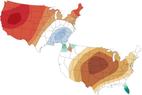
The latest maps from NOAA's Climate Prediction Center show where October 2020 is forecast to be much hotter and drier than average in the U.S. It's not a great outlook for the wildfire-affected West.
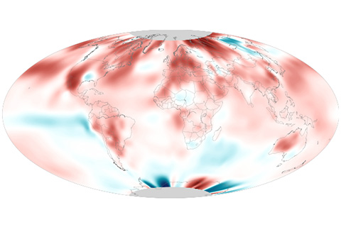
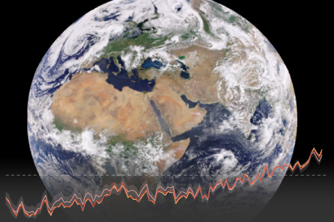
August 2020 was the second-hottest August on record, and it ended the hottest summer on record for the Northern Hemisphere.
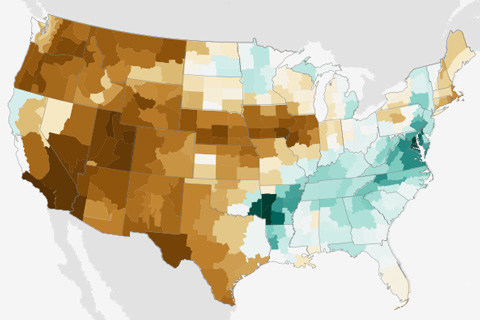
Extreme heat in the U.S. Southwest carried August 2020 into the record books as the country’s third-warmest August in the 126-year record. Despite heavy rain from landfalling tropical cyclones, national average precipitation was in the driest third of the record.
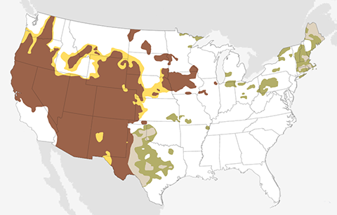
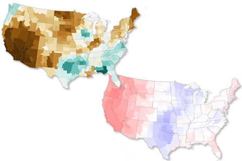
The September 2020 temperature and precipitation outlook favors a warmer- and drier-than-average September across the western United States, and a wetter-than-average month across the south-central Plains and much of the East.
July 2020 was the second-warmest July on record for the globe, as 2020 continues its scorching path to one of the hottest years on record.
Record-high sea level, noteworthy extreme weather, and rising levels of carbon dioxide in the atmosphere and oceans are just a few of the hundreds of highlights from Earth's annual checkup.
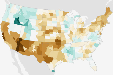
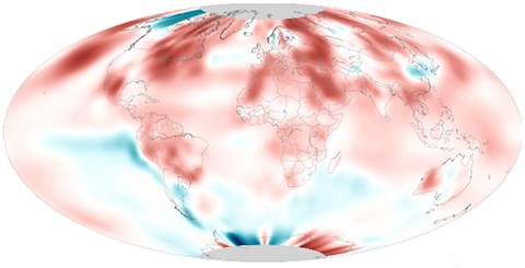
The latest monthly summary from the National Centers for Environmental Information also reported that the year-to-date temperature was the eighth warmest in the 126-year record.