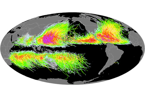
Researchers at NOAA’s National Climatic Data Center collaborate with tropical cyclone centers and scientific agencies around the world to assemble and maintain the International Best Track Archive for Climate Stewardship (IBTrACS), an inventory of tropical cyclones.
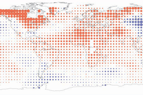
Across the globe, over land as well as sea, Earth’s average surface temperature for April 2010 made it the warmest April on record.
How is climate change affecting bird migration patterns? Birdwatchers across the country and around the world are contributing their time, both in the field and online, to answer that question.
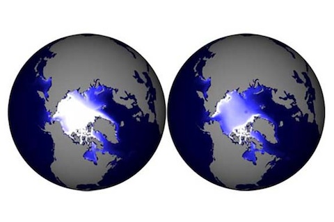
Scientists examine data from computer models to generate simulations of sea ice thickness now and three decades into the future.

How Is Climate Change Impacting Coasts?
May 12, 2010

Twice a month, scientists send weather balloons into the air to collect data about the atmosphere, from the ground all the way up to the darkness of near space. Many gathered for the launch of last week’s balloon, which marked 30 years of NOAA water vapor measurements in Boulder.
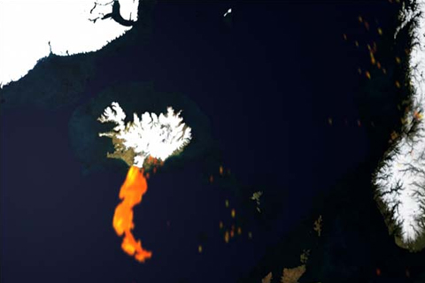
Iceland’s Eyjafjallajökull Volcano roared to life on April 14, 2010, injecting billowing clouds of steam and volcanic ash into the atmosphere.
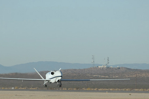
The Global Hawk research aircraft soars to hard-to-reach areas of the atmosphere to collect samples of trace gases and chemicals. Find out just how high the Global Hawk flies.
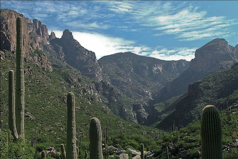
Curiosity is a cruel master, says Dave Bertelsen. Over the past 25 years, he has hiked over 12,000 miles through a desert canyon, just to see what was blooming. He found a few surprises along the way.
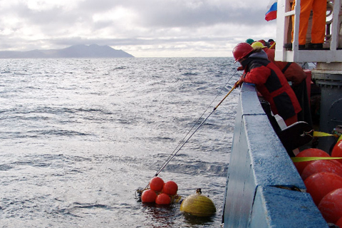
In the summer of 2009, sea ice receded to its third-smallest area in recorded history. The reduced sea ice cover in the Arctic allowed an international group of scientists to study areas of the ocean that they have never been able to reach before.