ENSO Blog
Guest co-author Dr. Kai-Chih Tseng is a postdoctoral research scientist at Princeton University and the NOAA Geophysical Fluid Dynamics Laboratory who is an expert on climate variability and prediction, including the study of atmospheric rivers. In the summer of 2022, Dr. Tseng will begin an assistant professor position in the Department of Atmospheric Science at National Taiwan University.
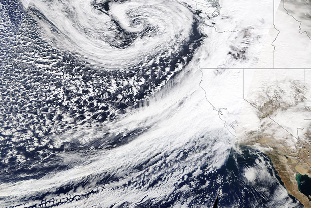
This past December, a mind-boggling 18 feet of snowfall fell in the California Sierra Nevada Mountains! How does so much snow fall in one place in such a short period of time? One of the primary phenomena responsible for such extreme rain and snowfall, particularly in regions like the western U.S., is…
Read article
La Niña is likely to hang around through the spring, with a transition to neutral favored for the May–July period. Hop in, and we’ll cruise through some updates on current conditions and the recent past!
On the road again
The November–January average Oceanic Niño Index, that is, the three-month-average sea surface temperature anomaly in the Niño-3.4 region of the tropical Pacific, was -1.0 °C. Anomaly means the difference from the long-term average; long-term is currently 1991–2020. This marks our fifth three-month period in a row with an Oceanic Niño Index that exceeds the La Niña threshold of -0.5 °C. Passing this mile marker means this La Niña has persisted long enough to be awarded…
Read article
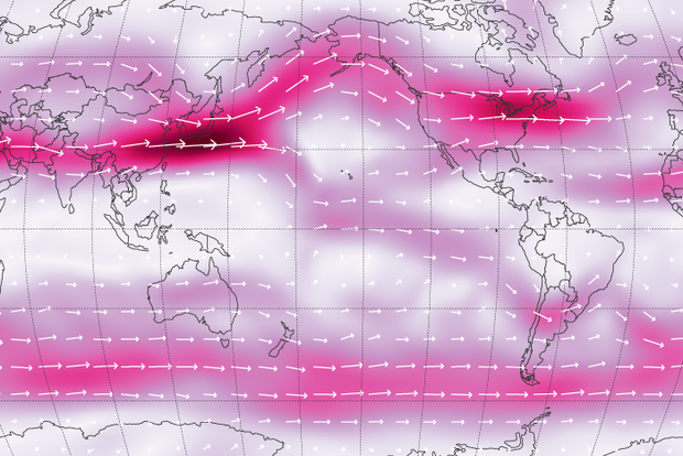
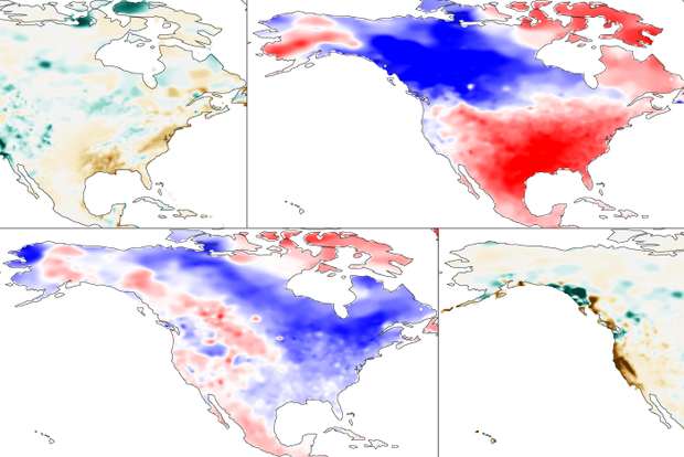
This is a guest blog by Tim Woollings , a professor of climate science in the Department of Physics at the University of Oxford in the UK. Tim recently won the Louis J. Battan Award from the American Meteorological Society for his book “ Jet Stream : A Journey Through our Changing Climate.”
The term jet stream is used increasingly in both weather forecasts and news reports of extreme events, from cold spells and flooding to heatwaves and droughts. But what is the jet stream, and why do we care about it so much?
The jet stream is a fast, narrow current of air flowing from west to east that encircles the globe (not to be confused with the Gulf Stream which is instead an ocean c…
Read article
Happy new year! This La Niña event is likely near peak strength as we start 2022. Related impacts to global weather and climate will continue through the rest of winter and into the spring, however, because climate impacts lag tropical Pacific sea surface temperature changes. Forecasters favor a transition to neutral in the April–June period.
Chutes and Ladders
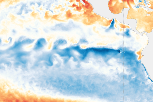
The sea surface temperature in the Niño-3.4 region of the tropical Pacific—our primary measurement of the El Niño/Southern Oscillation (ENSO) system—was 1.1° C cooler than the 1991–2020 average in December, via the ERSSTv5 observation dataset.
The three-month temperature deviation from average in Niño-3.4, the Oceanic Niñ…
Read article
La Niña continues as the Northern Hemisphere heads into winter, and forecasters are confident that it will hang around through the rest of the winter. This La Niña, the second in two years, will likely transition to ENSO-neutral sometime in the spring. There’s about a 60% chance the late spring and summer will feature neutral conditions.
Magnifying glass
Time for a closer look at the tropical Pacific, the home of the El Niño-Southern Oscillation climate pattern!
La Niña’s hallmark cooler-than-average ocean surface is readily apparent across much of the tropical Pacific. Over the past few weeks, cool anomalies have increased in the eastern Pacific, and in general we see a well-es…
Read article