Three experts explain why La Niña provides no relief from the excess planetary heating due to rising greenhouse gases.
Call it what you like—triple-dip, three-peat, three-bean salad—we are facing the third La Niña winter in a row.
It's all but a done deal: odds of La Niña this winter are higher than 90 percent. Plus a reminder list of why we care so much about La Niña.
For summer heat in Texas, whether it's La NIña now is less important than whether it was La Niña the previous winter.
The tropical Pacific appears to be hopelessly devoted to La Niña for at least the early part of winter.
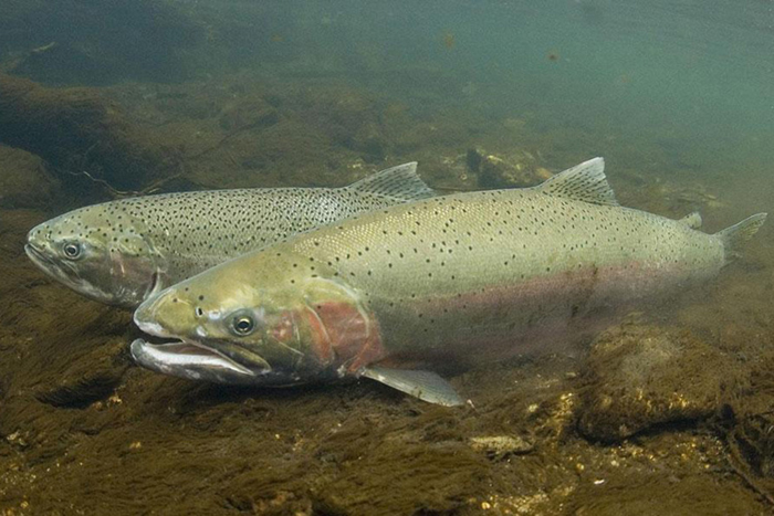
From the coasts of South America to the Galapagos Islands, the story of ENSO cannot be told without discussing its impact on marine life. But just as ENSO can affect climate patterns thousands of miles away from the equatorial Pacific, ENSO can also affect marine life. And there is no better example of this than its impacts on Salmon across the North Pacific. In this interview with expert Dr. Nate Mantua, learn all about the complexities of salmon and ENSO.
It's no joke: forecasts are still favoring a La Niña three-peat this winter.
Alaska is more than 4,000 miles from the equator. Does the influence of El Niño and La Niña reach that far?
The chances that La Niña will last through summer are only slightly higher than the chances of a short dip into neutral before returning to La Niña by early winter. How will it affect the hurricane season?
Residents of Hawaii who've felt left out over the years as the ENSO blog has largely focused on the Lower 48, here's a post all your own.