Polar Vortex Blog
The stratospheric polar vortex is a seasonal phenomenon. It forms in late summer, when the polar region starts to lose incoming sunlight as Earth’s orbit causes the planet’s axis to be tilted away from the Sun. Its strength peaks in winter, during polar night. In spring, as the sunlight returns, and the polar stratosphere begins to warm up, the writing is on the wall: the polar vortex’s days are numbered. The equator-to-pole temperature gradients that maintain the west-to-east flowing winds in the stratosphere will weaken, and the polar vortex winds will dissipate. They will be replaced by polar stratospheric winds that flow weakly east-to-west through summer until the vortex reforms [footno…
Read article
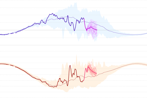
As we’ve mentioned a few times before in this blog, the stratospheric polar vortex has been pretty active this winter. The screaming-fast winds that circle the North Pole high above the surface during Polar Night have completely reversed twice. (And in between those two events, there was a maybe: the west-to-east winds* at 60 degrees fluttered around zero, but may not have actually reversed for long enough to officially qualify.)
As such events often do (it’s why we pay attention to them!), the one in January probably played some role in the extreme cold in the central U.S. in January that kept the winter from being a complete bust. (Footnote 1).
All this starting, stopping, re…
Read article
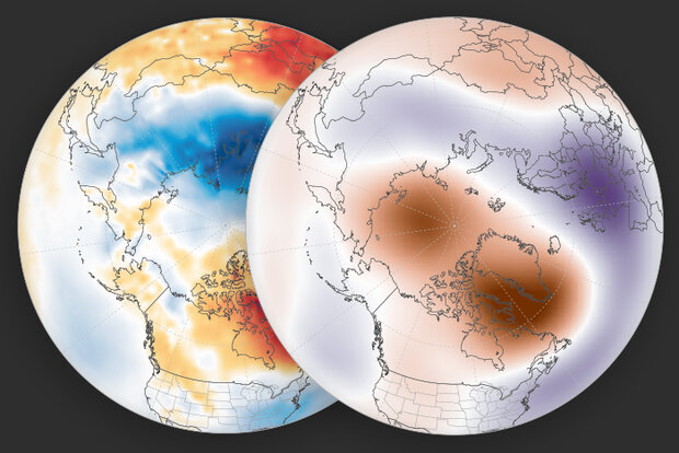
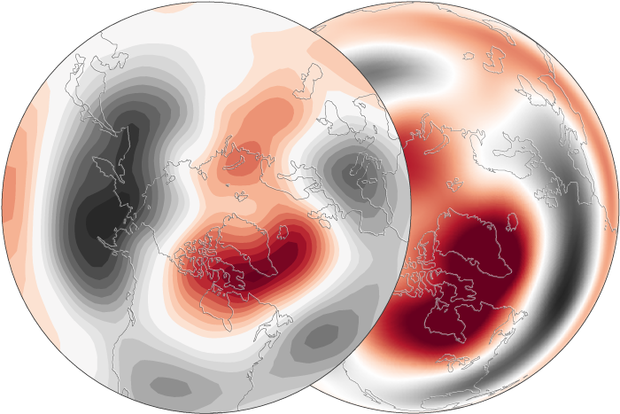
We’ve talked about how the reversal of the west-to-east winds at 60 degrees North during a major sudden stratospheric warming sets up a feedback between large atmospheric waves and the winds, and how this results in the stratospheric wind changes being communicated down into the troposphere. But what does this mean for weather patterns down here after the polar vortex is disrupted?
By taking the average of the surface temperature and atmospheric thickness for the 30 days after all the major sudden stratospheric warmings in the observational record, we can average out day-to-day variations in the weather and see more clearly what weather patterns related to major warmings look like.
…
Read article
“It could be … it might be … it…!” Wait, is it? A homerun for the stratosphere? After a brief respite, the stratospheric polar vortex is expected to weaken again with potentially another major sudden stratospheric warming forecast to occur in the next week. But didn’t we just have a sudden stratospheric warming event?? Read on to find out what’s in the stratosphere’s line-up and how this double header fits in with typical stratosphere behavior.
Loading the atmospheric bases
The atmospheric players have been positioning themselves again for another polar vortex disruption. First up, the current stratospheric conditions are primed for tropospheric wave activity because the polar vo…
Read article
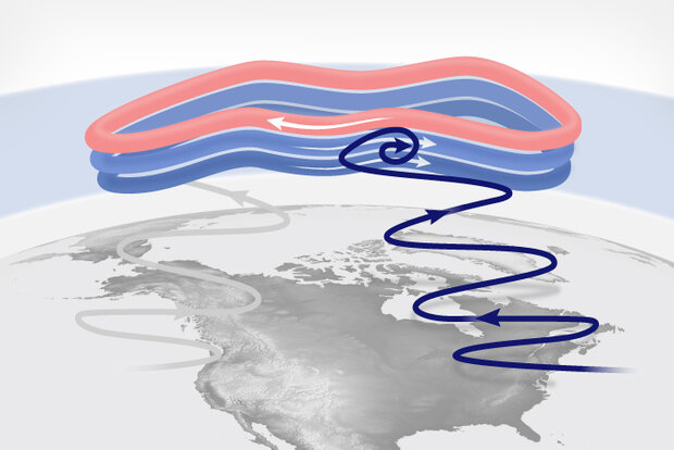
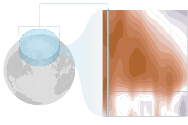
With the occurrence of a major disruption to the polar vortex (or sudden stratospheric warming) on January 16 2023 [footnote 1], one of the first questions everyone asks is “How can a disruption way up in the Arctic stratosphere affect the winds and weather far below in the troposphere?”.
A stratospheric traffic accident
Scientists have a pretty good understanding of how a reversal of the winds ~19 miles above the Arctic influences the winds at lower altitudes, at least down to about the tropopause (the altitude where the troposphere transitions to the stratosphere, ~6-8 miles above earth’s surface at the poles). As we mentioned in this post, huge planetary-scale waves in the atmospher…
Read article