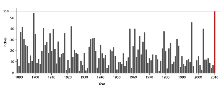
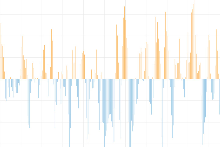
NOAA's Climate Scene Investigators analyzed why the mid-Atlantic region had record-setting snowstorms this winter. The team looked for but found no human "fingerprints" on the severe weather. Instead, they fingered two naturally occurring climate patterns as co-conspirators in the case.
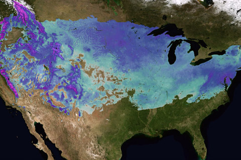
In early February, two weather systems brought record snowfalls to Washington, D.C., and other parts of the U.S. mid-Atlantic region. At the same time, organizers of the 2010 Winter Olympics in British Columbia, Canada, were dealing with a deficit of snow.

In May and June each year, speculation about the coming of the monsoon fills newspapers and conversations across India. Everyone is concerned about if, when, and how much rain will arrive. But none have more at stake than India’s over 100 million farming households.
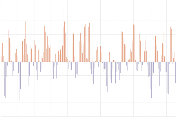
The Pacific-North American teleconnection pattern influences regional weather by affecting the strength and location of the East Asian jet stream, and subsequently, the weather it delivers to North America.
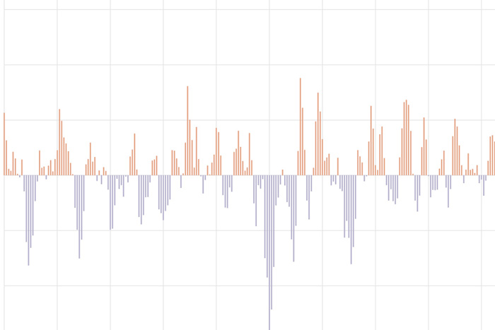
The Arctic Oscillation (AO) refers to an atmospheric circulation pattern over the mid-to-high latitudes of the Northern Hemisphere. The most obvious reflection of the phase of this oscillation is the north-to-south location of the storm-steering, mid-latitude jet stream.
The North Atlantic Oscillation tracks a seesawing of surface pressure between two parts of the North Atlantic. Different phases often bring predictable changes in winds, temperature, and precipitation in the United States and Europe.
It’s March Madness, ENSO style! Our blogger discusses why the North American precipitation pattern this past winter looked more like the response to a moderate-strength La Niña than to a weak event.
A new paper looked at 20 years work of real-time ENSO Model forecasts and found some interesting patterns. Did you know models found it pretty freaking hard to predict the onset of La Nina events?
Why no one should expect a perfect match between what happens during a La Niña winter and the expected La Niña pattern. But knowing whether it may be a El Niño or La Niña winter is still useful!
What are the odds of a stratospheric polar vortex disruption this winter? We take a look at two things that help predict our chances for this extreme event.