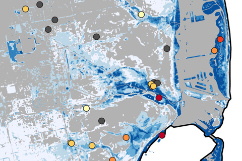
Hurricanes can harm people not just by causing injuries, but also by flooding hospitals that would otherwise deliver needed treatment.
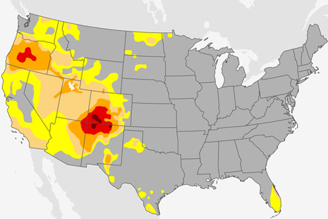
Stubborn drought affected the U.S. Southwest and Four Corners region throughout 2018, stressing water supplies, agriculture, and natural ecosystems.
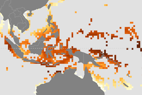
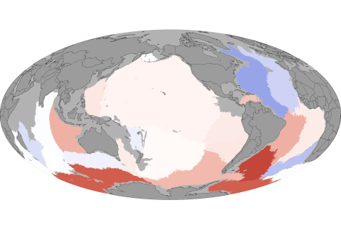
Corals reefs face double threats from rising atmospheric carbon dioxide: severe heat stress and ocean acidification. NOAA researchers have produced maps of future changes in both threats to allow managers to identify the most vulnerable reefs.
This animated gif shows how October average temperatures in the contiguous United States are projected to change in coming decades if global carbon dioxide emissions continue along a high-emissions pathway.
Earth's coldest waters are warming, an indication that global warming has reached one of the most remote corners of the ocean's circulatory system.
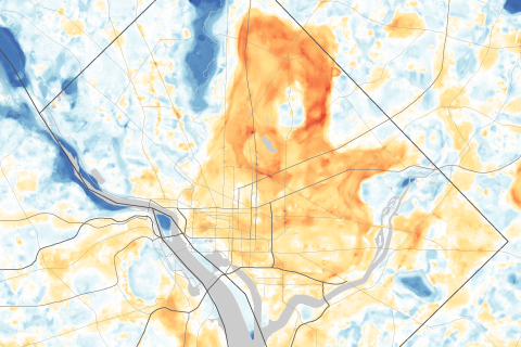
Use a slider to compare satellite images of Washington, DC, and Baltimore, MD, with maps of afternoon temperatures to see the hottest and coolest parts of the city on a late summer day.
Forecasters think the tropical Pacific climate phenomenon known as El Niño is likely to visit this winter. What might that mean for snow?
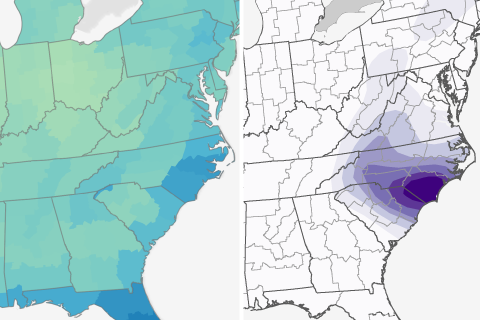
How do rainfall totals predicted for Florence compare to an average September in the U.S. Southeast?
In the bull's-eye of heaviest rainfall predicted for Hurricane Florence, parts of North and South Carolina may see more than 4 times their average September rainfall in a single week.
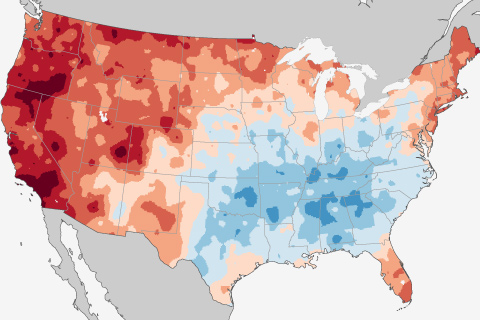
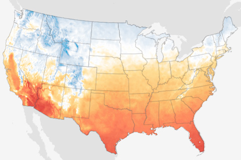
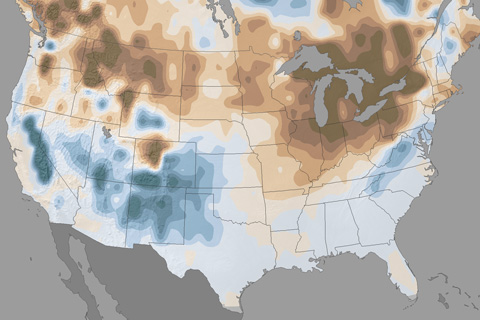
Warming in the West outstrips cooling in the East for a slight overall U.S. warming trend in the first month of fall.
The 15 years from 1998–2012 were the warmest on record at that time, but the rate of global surface warming was slower than it had been in the 2-3 decades prior thanks to several natural influences. Meanwhile, the ocean's heating imbalance continued to climb.