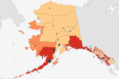
Alaska’s coastal waters are especially vulnerable to the drop in pH—acidification—that comes when excess carbon dioxide dissolves into the ocean from the atmosphere. These maps show relative risk levels for commerical and subsistence fisheries.
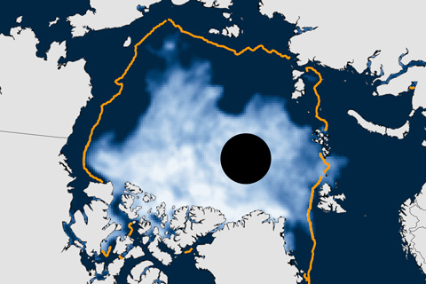
The annual minimum was 5.02 million square kilometers (1.94 million square miles), making 2014 the sixth smallest extent in the satellite era, which began in 1979.
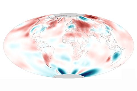
August 2014's globally averaged surface temperature and sea surface temperatures both set new records.
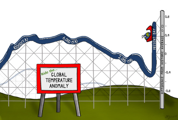
Natural variability can explain much of Earth's average temperature variation since the end of the last ice age, but over the past century, global average temperature has risen from near the coldest to the warmest levels in the past 11,300 years.
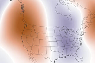
U.S. temperature extremes and the polar jet stream
September 16, 2014
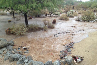
Record-breaking rain in Arizona
September 10, 2014
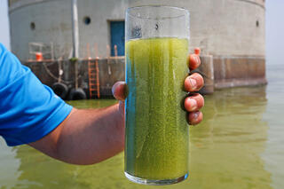
Spring climate plays major role in Lake Erie algae blooms
September 8, 2014
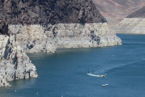
On July 11, Lake Mead reached its lowest water level since construction of the Hoover Dam in the 1930s. Many scientists are concerned that the prolonged drought could be a sign that the region will face significant water supply challenges due to climate change.
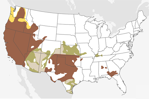
Drought in the far West and the southern portion of the Great Plains—regions that are already experiencing extreme and exceptional drought—will likely continue or worsen through September.
2014 temperature extremes: U.S. runs hot and cold
August 29, 2014