
It's been a tough year for the globe's coral and the scientists who use coral to paint a picture of ENSO back thousands of years.
The 2015-2016 El Niño will go down as one of the strongest on record, and also, thanks to El Niño Rapid Response Campaign, one of the best observed.
With multiple sea surface temperature datasets come questions. What are they all for?
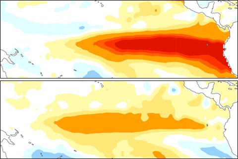
You're not the only one wondering if we will see El Niño grow or continue into this coming winter 2015. How useful are March winds and subsurface temperatures across the tropical Pacific Ocean in predicting winter El Niño or La Niña states?
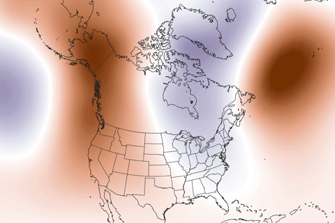
Guest blogger Dennis Hartmann makes the case that warm waters in the western tropical Pacific—part of the North Pacific Mode climate pattern—are behind the weird U.S. winter weather of the past two seasons.

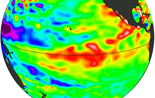
At the beginning of February, the atmosphere was looking a little bit like El Niño. Is this just another rolling stone?
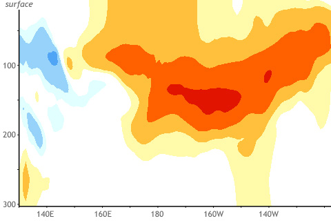
The tropical Pacific Ocean sloshes around like water in your bathtub. These waves are as important as the vortex of water that spirals down the drain.
What's behind the drop in probabilities this month? And why might forecasting this event be particularly tricky?
How El Niño is like different flavors of ice cream. Seriously.