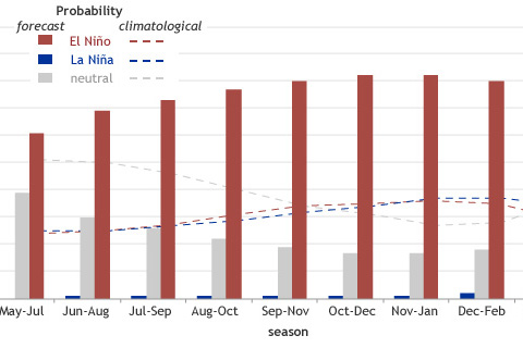
What's behind the drop in probabilities this month? And why might forecasting this event be particularly tricky?
How El Niño is like different flavors of ice cream. Seriously.
As of late August 2014, tropical atmospheric temperatures appear to be responding more strongly to the ocean than they typically do at this early stage of El Niño development.
If you are someone who wants more or stronger ENSO events in the future, I have great news for you–research supports that. If you are someone who wants fewer or weaker ENSO events in the future, don’t worry–research supports that too.
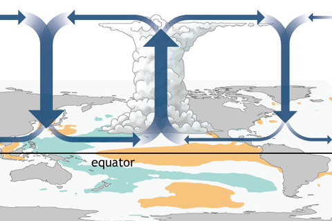
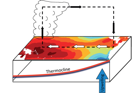
How do changes in the equatorial Pacific Ocean impact places much farther away? The answer for the tropics, at least, lies in changes to the equator-wide atmospheric circulation called the Walker Circulation.
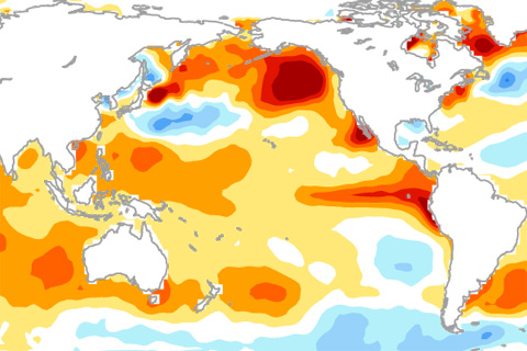
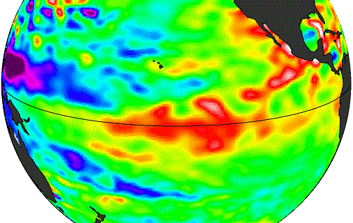
Why hasn't El Niño been declared yet? The answer might lie in the gradients of sea surface temperatures across the tropical Pacific Ocean.
One of ENSO’s most important influences is to the Indian Monsoon—the large-scale circulation pattern that brings the Indian subcontinent the vast majority of its yearly rainfall. And while La Niñas tend to increase monsoon rainfall, the monsoon’s relationship with El Niño can be a little more complicated.
We’d like our forecasts—both weather and climate—to be simple and certain. Because of the fluid and chaotic nature of the ocean and atmosphere, however, forecasts are never about certainty: they’re about probability.
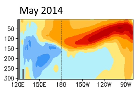
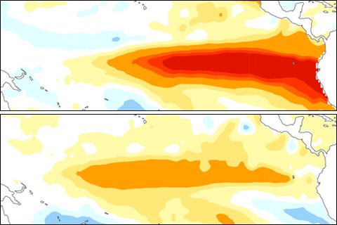
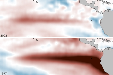
Chances that an El Niño will occur by summer are above 70%, hitting 80% by the fall. But subsurface temperature anomalies have tapered off some from earlier this spring, decreasing the odds the event will be as strong as the El Niño of 1997-98.