
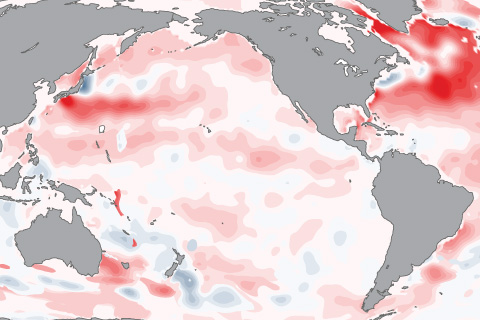
The 2015-2016 El Niño will go down as one of the strongest on record, and also, thanks to El Niño Rapid Response Campaign, one of the best observed.
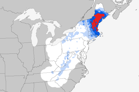
If you're thinking of bemoaning today's weather, comfort yourself with some history: today's the anniversary of the most severe Northeast snowstorm in the historical record. Guest blogger Mike Squires talks about how the February 22-26, 1969, snowstorm ranks head and shoulders above any other storm to hit the region since records began in 1900.
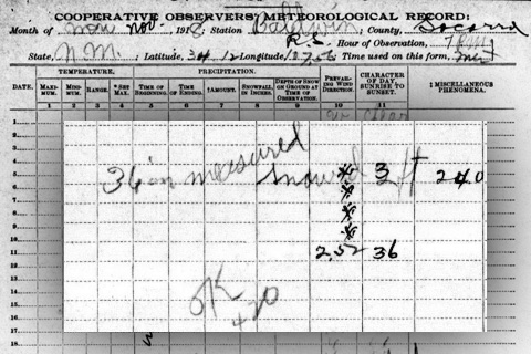
When deciding if a snow event qualifies as a federal disaster, FEMA considers, among other things, how the event compares to previous snowstorms in the historical record. After spending a week going through those records, NECI's Deke Arndt talks about why snow can be the most difficult kid in the climate schoolroom.
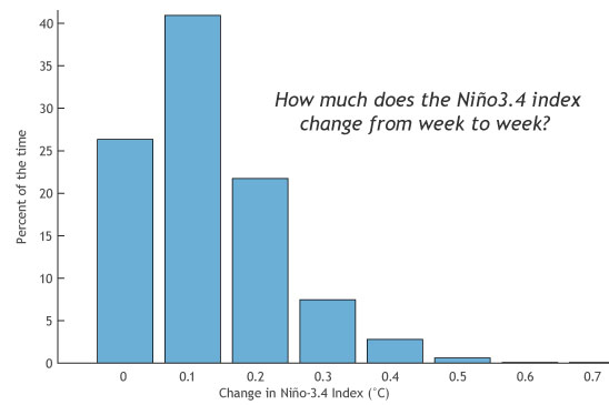
“El Niño is Strong!” “No, it’s Moderate!” “But the [insert your favorite ENSO indicator here] is the largest it’s been since the El Niño of 1997-98!”
ENSO blogger Tony Barnston explains why climate forecasters can't get by with just a single indicator for predicting El Niño and La Niña.
How can warming at Earth’s surface have slowed when energy accumulation is growing? The role of our oceans—including ENSO—is key.
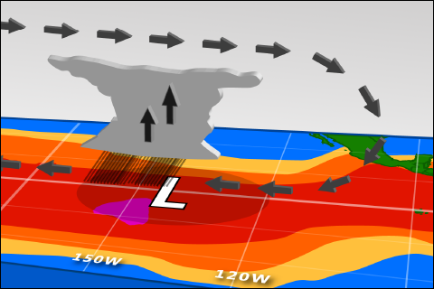
Sea surface temperatures are up. So why haven't forecasters declared El Niño conditions?
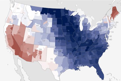
During March 2013, most of the eastern United States was notably cooler than average, with the exception of New England. Along the Rockies, temperatures were closer to normal.