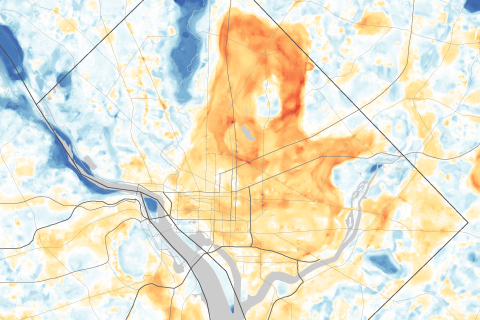
Use a slider to compare satellite images of Washington, DC, and Baltimore, MD, with maps of afternoon temperatures to see the hottest and coolest parts of the city on a late summer day.
Use a slider to compare satellite images of Washington, DC, and Baltimore, MD, with maps of afternoon temperatures to see the hottest and coolest parts of the city on a late summer day.