When volcanoes roar: protecting the public and tracking long-term climate impacts
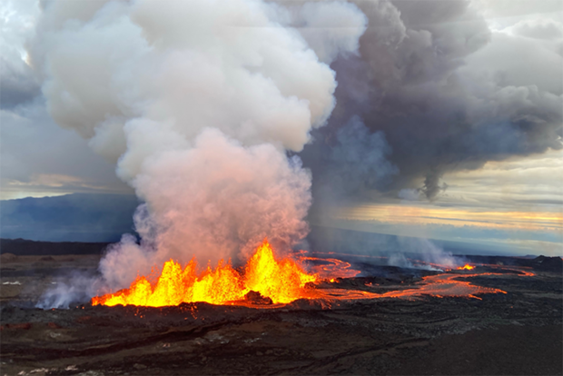
Volcanic eruptions affect human health and safety, sometimes far from the eruption site. Credit: NOAA
Volcanic eruptions affect human health and safety, sometimes far from the eruption site. Credit: NOAA
When volcanoes roar: protecting the public and tracking 2022 was a busy year for volcanic eruptions with Hawaii's Mauna Loa and Kilaeau erupting simultaneously, along with Mount Semeru, Indonesia and the Hunga undersea volcano in Tonga. While the United States Geological Survey is the primary agency that monitors volcanic activity in the United States, the National Oceanic and Atmospheric Administration (NOAA) oversees safety systems for tsunamis and other volcano-related threats, as well as studies the impact of volcanic gasses on our global climate.
When a volcano erupts, NOAA provides data, satellite imagery and other information used in air quality alerts, ashfall advisories, and tsunami warnings. Mauna Loa, located on the big island of Hawaii, erupted in 2022 for the first time since 1984. During this eruption, which could be seen from space, NOAA and partners released air quality alerts to protect people from vog, a hazy mixture of sulfur dioxide gas and particulate matter.
Read more at the link below.