Western Water Assessment releases new dashboard for Utah
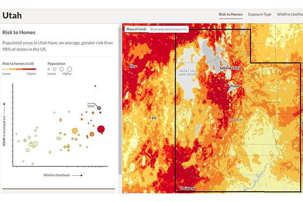
One of the new dashboard’s many features covers wildfire risk to communities. Credit: Western Water Assessment
One of the new dashboard’s many features covers wildfire risk to communities. Credit: Western Water Assessment
The Western Water Assessment (WWA), a NOAA RISA team, has just released a dashboard to complement the recently published Utah Hazard Planning Tool, which provides resources about the historical incidence, current risk, and future projections of natural hazards in the state. The dashboard is a compilation of online, interactive information tools, maps, and graphics about natural hazards in Utah. The information is specific to Utah, but is relevant to most of the West for information on avalanches, cold temperature extremes, dam failure, debris flow, drought, extreme heat, flooding and heavy rainfall, landslides, wildfire, wind events, and winter storms.
Read more at the link below.