Precipitation study in Colorado Rockies strikes gold during epic winter
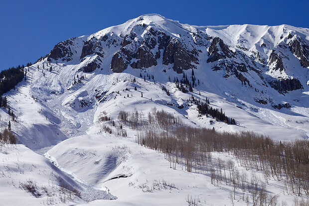
Snow blanketed much of Colorado’s Rocky Mountains in the winter of 2022-2023. Credit: NOAA
Snow blanketed much of Colorado’s Rocky Mountains in the winter of 2022-2023. Credit: NOAA
In the thrall of a 22-year megadrought, the record snowpack that built up in southwestern Colorado was a welcome break in a string of dry winters.
For a pair of NOAA scientists, part of a team conducting an intensive two-year study of how precipitation forms in the East River watershed near Crested Butte, the softening spring snows provided just a little extra challenge for a scheduled ski and snowshoe trek into the rugged mountain valley in late April.
“Ski conditions were not great,” said Janet Intrieri, a research scientist with NOAA’s Physical Sciences Laboratory. “In the morning it was super crusty, in the afternoon it was super mashed-potato-y. But we got what we needed.”
When scientists from PSL and CIRES installed a comprehensive, state-of-the-art observing network in the East River watershed in the fall of 2021 to study how precipitation forms in the complex, high-altitude terrain, they couldn’t have imagined a year like this. As storm after storm plastered the mountains with snow this winter, the network of radars, instrumented towers, and meteorological sensors measured temperatures, precipitation amounts, soil moisture and snowpack properties. Complementing this array were two stations installed nearby by Global Monitoring Laboratory field engineers and researchers consisting of sophisticated radiometers, ceilometers, a total sky imager, a cloud optical depth sensor, and other meteorological instruments.