NOAA and community partners will map heat inequities in the United States and abroad
<p>The summer 2022 campaign will observe heat islands across the United States as well as Rio de Janeiro and Freetown. Credit: NOAA Climate.gov</p>
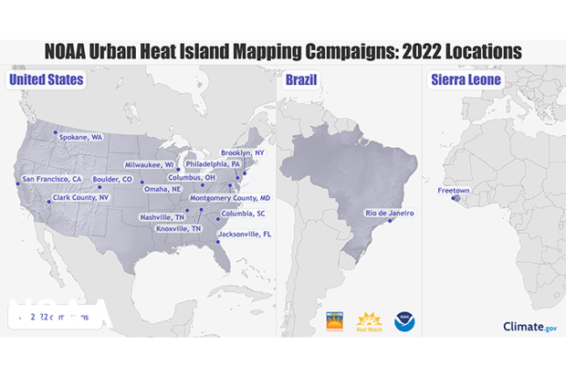
The summer 2022 campaign will observe heat islands across the United States as well as Rio de Janeiro and Freetown. Credit: NOAA Climate.gov
On April 26th during the opening remarks for the National Integrated Heat Health Information System (NIHHIS) National Meeting, NOAA Administrator Dr. Richard Spinrad announced that NOAA and community partners will be mapping heat inequities in 14 communities across the country this summer, and two international cities.
“Our nation faces a climate crisis that has exacerbated inequities for the low-income and communities of color,” said NOAA Administrator Rick Spinrad, Ph.D. “NOAA is helping communities measure their hottest places so that they can use this information to develop strategies to reduce the dangerous effects of heat and help us create a Climate Ready Nation that is resilient in a changing world.”
Read more at the link below.