High-resolution climate model simulates atmospheric river relationships
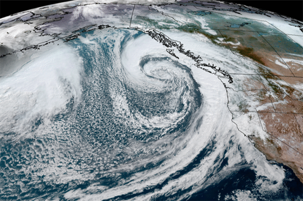
Atmospheric river approaches the West Coast in October 2021. Credit: NOAA
Atmospheric river approaches the West Coast in October 2021. Credit: NOAA
Atmospheric rivers are long, fast-moving bands of water vapor formed in or around tropical areas, and can result in extreme precipitation events as they make landfall. This phenomenon has been linked to natural climate variations like El Niño/Southern Oscillation (ENSO) and Pacific Decadal Oscillation (PDO), but these connections need to be better understood. A new study, funded partially by the Climate Program Office’s Climate Variability & Predictability (CVP) Program, evaluates the accuracy of a high-resolution and low-resolution Community Earth System Model (CESM) compared with real world observations. An international team of researchers, including CVP-funded scientist Ping Chang (Texas A&M University), found that the high-resolution simulation was able to demonstrate accurate details showing the relationships between atmospheric rivers and major Northern Hemisphere climate modes at seasonal-to-decadal time scales.
Read more at the link below.