ENSO Blog
La Niña—the cool phase of the El Niño-Southern Oscillation climate pattern—weakened over the past month, and forecasters expect a transition to neutral conditions in the next couple of months. We’ll check in with the tropical Pacific to see how things are going before continuing the journey into understanding winter daily temperature variability that I started in December’s post.
Current events
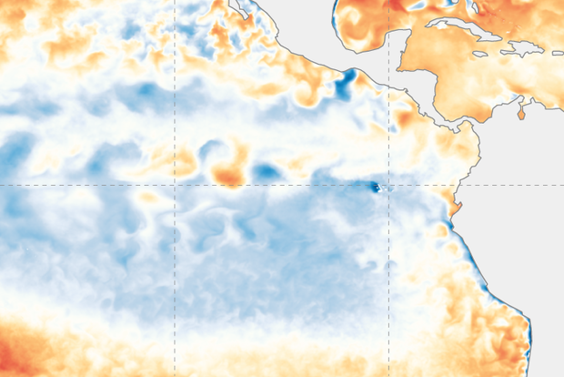
The sea surface temperature in the Niño-3.4 region in the tropical Pacific came in at 0.75 °C (1.4 ˚F) cooler than the long-term average in January according to ERSSTv5, our most consistent historical dataset.
This is the second month in a row with that the Niño-3.4 anomaly (anomaly = ”di…
Read article
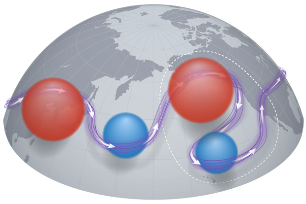
“How will climate change influence ENSO?” is one of the most common questions that we get on the ENSO Blog. While it makes sense folks want to know about the future changes in El Niño and La Niña—are they becoming more/less frequent? stronger? weaker? (1)—there is an even more basic question for future climate change that scientists are pondering:
How will trends in sea surface temperatures change across the equatorial Pacific Ocean?
It is very likely that the equatorial Pacific Ocean is going to warm up somewhere, but where exactly the strongest warming occurs is an important question. In particular, scientists want to know more about the geographic pattern of trends (2). By modifyin…
Read article
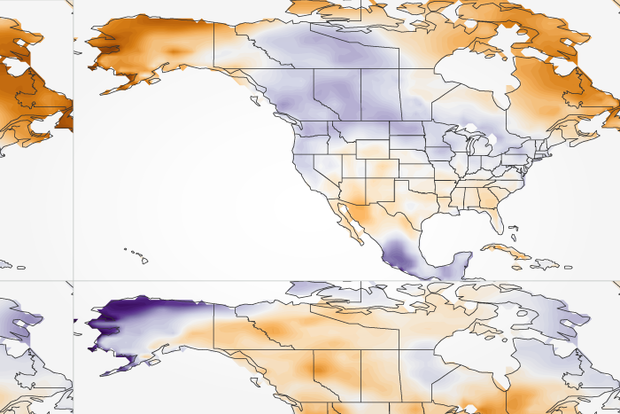
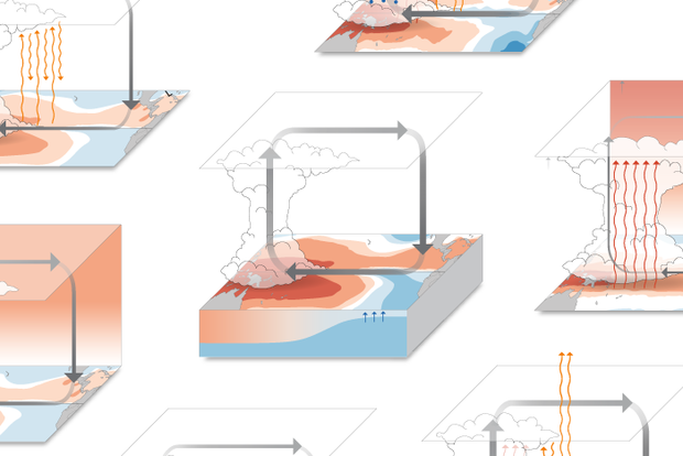
Hello from the 103rd Annual Meeting of the American Meteorological Society! Your trusty ENSO correspondent is writing to you from Denver, CO this January. (ENSO = El Niño/Southern Oscillation, the entire El Niño/La Niña system.) Today I have an overview of current conditions and the forecast, before getting back to the question I posed last month—how does ENSO affect daily temperatures during the winter? Let’s get to it, as there’s a lot of ground to cover this month!
Current events
The sea surface in the tropical Pacific has been cooler than the long-term average (1991–2020, currently) since mid-2020, and it remains so. However, we did see some weakening of this pattern over the past …
Read article
This is a guest post by Breanna Zavadoff and Marybeth Arcodia. Dr. Zavadoff is an Assistant Scientist at the University of Miami Cooperative Institute for Marine and Atmospheric Studies. Her current research focuses on U.S. West Coast atmospheric rivers as well as subseasonal Madden-Julian Oscillation predictability. Dr. Arcodia is a Postdoctoral Researcher at Colorado State University working in the Barnes Group. Her current research explores sources of climate predictability from subseasonal to decadal timescales using explainable artificial intelligence techniques. She also writes for the Seasoned Chaos blog, a subseasonal to seasonal forecasting blog for scientists and non-scientists ali…
Read article
As our regular readers will be very aware, La Niña has been rolling along in the tropical Pacific for many months, and our third La Niña winter in a row is under way. La Niña is the cool phase of the El Niño-Southern Oscillation (“ENSO” for short) climate pattern. The current forecast is for La Niña to continue into the winter, with 50-50 chances for La Niña and neutral in the January–March average.
Conditions in the tropical Pacific ocean-atmosphere system have been consistent with La Niña for long enough that, in November, one of our frequent readers commented—accurately—that they might as well have just re-read the October post! However, while La Niña seems stuck in a rut right now, th…
Read article