
Image caption
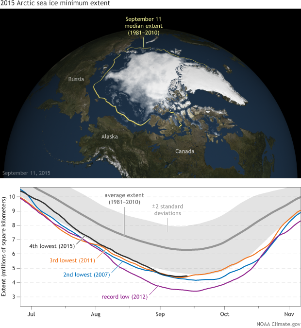
Top: Map of Arctic sea ice on September 11, 2015, the date it reached its fourth-lowest extent in the satellite record. Bottom: Graph comparing lowest extents to the climatological average.
Top: Map of Arctic sea ice on September 11, 2015, the date it reached its fourth-lowest extent in the satellite record. Bottom: Graph comparing lowest extents to the climatological average.