
Image caption
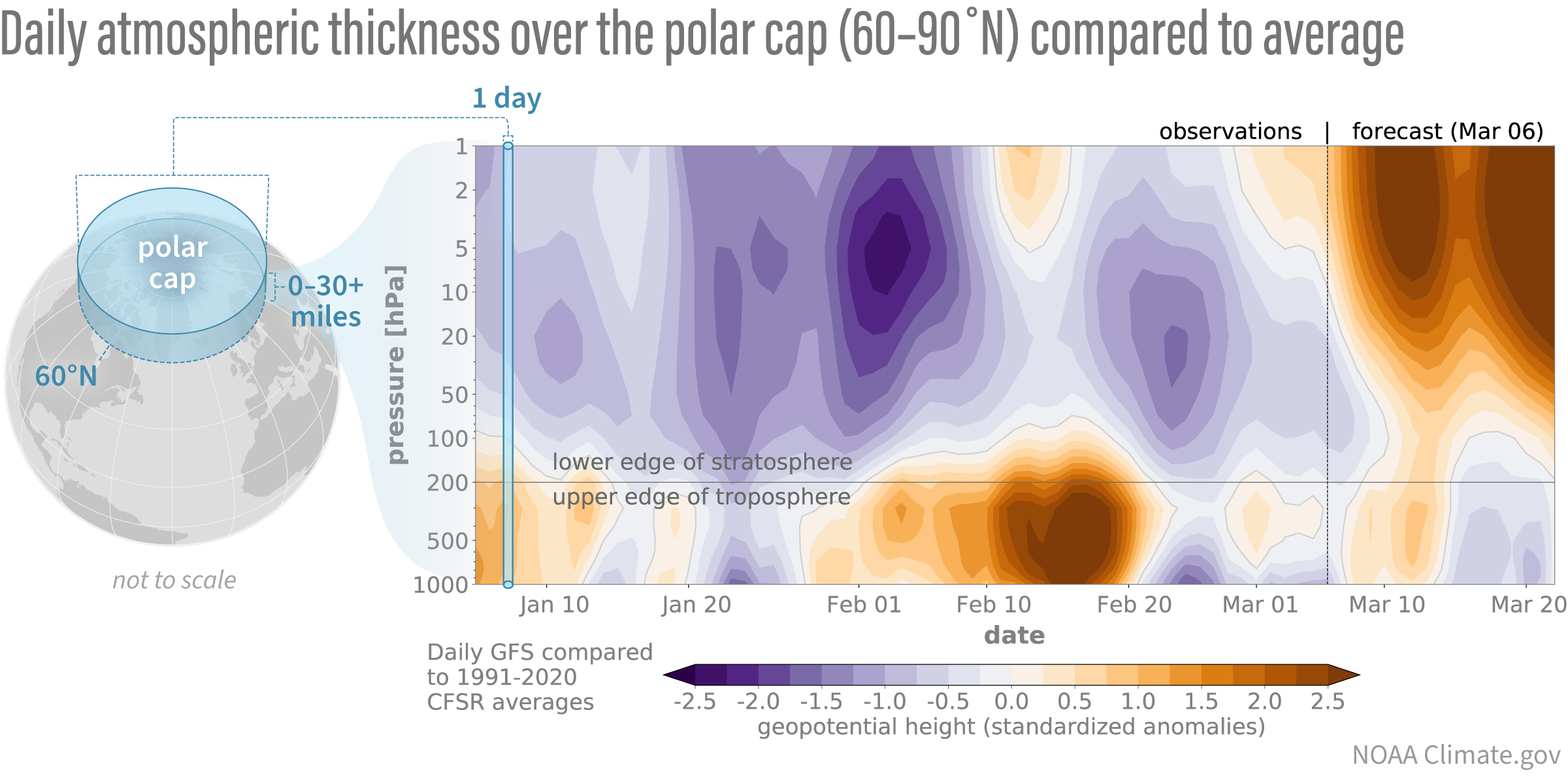
Differences from average atmospheric thickness (“standardized geopotential height anomalies”) in the column of air over the Arctic for the stratosphere and troposphere. Since the beginning of the year, low-thickness anomalies (purple shading indicative of a stronger than average polar vortex) have dominated the stratosphere but only periodically coupled down to the troposphere. Latest forecasts show a dramatic change with thickness anomalies increasing (orange shading), consistent with a polar vortex disruption. These stratospheric anomalies are preceded by tropospheric anomalies of the same sign, hinting at a nudge from below. However, it’s too soon to tell whether these stratospheric anomalies will then drip down into the troposphere again. Standardized anomalies are based on departures from the 1991-2020 Climate Forecast System Reanalysis climatologies and have been divided by the standard deviation. Data are from the Global Forecast System observational analysis and forecast.