
Image caption
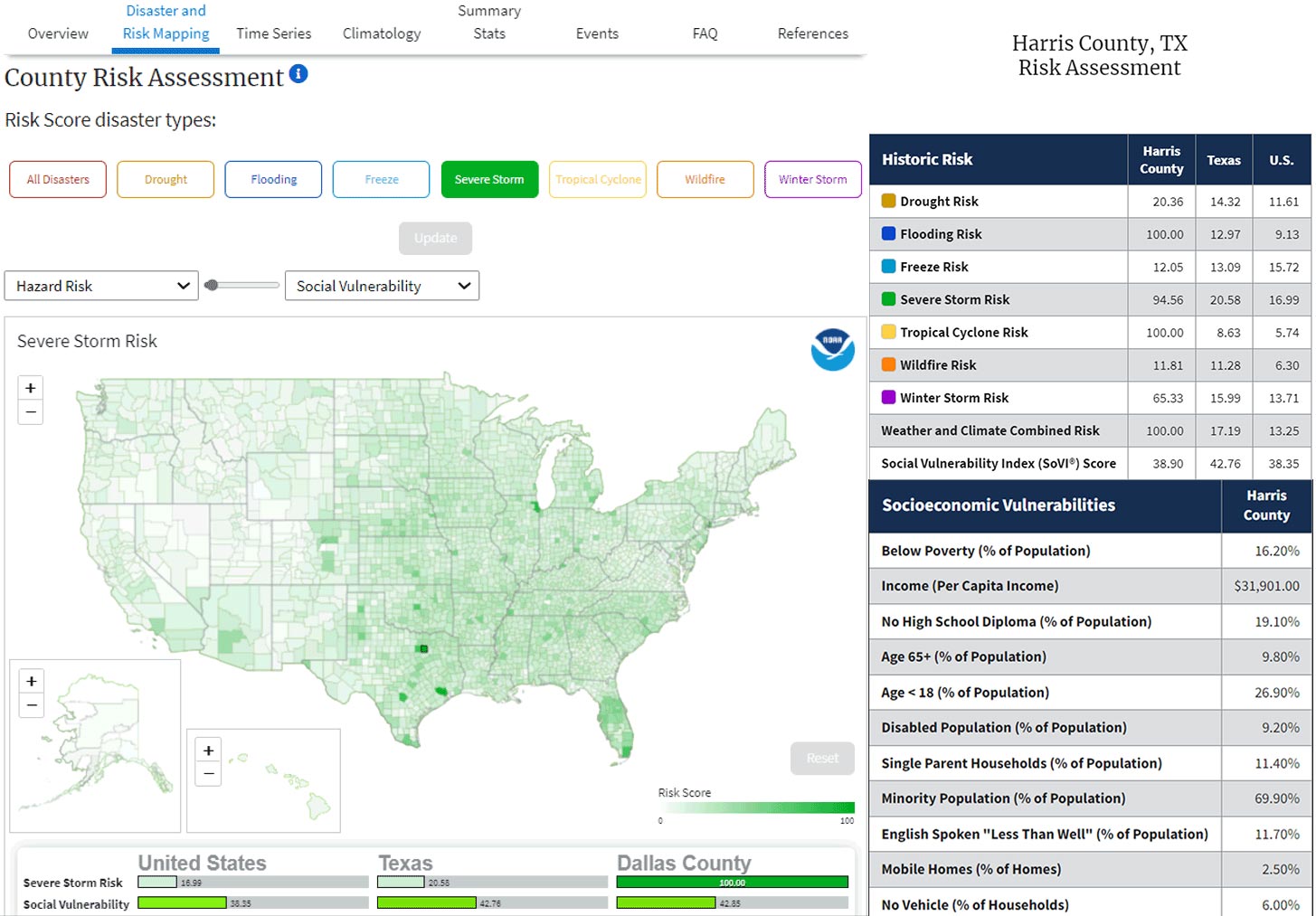
NOAA's county-level risk mapping tool allows users to view risk scores based on historical and projected occurrence of billion-dollar disasters, and how those scores overlap with social vulnerability based on population age, income, and other factors. Screenshots from NOAA NCEI Billion-dollar disaster mapping tool.