
Image caption
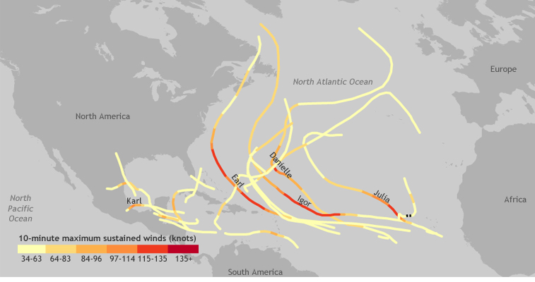
This map shows the path and 10-minute maximum sustained wind speeds of all named storms in the Atlantic Ocean during the 2010 hurricane season. Paths with names were major storms (Category 3 hurricanes or stronger on the Saffir-Simpson Scale). Black dashed lines indicate a drop in intensity to below tropical storm strength. Map by Hunter Allen, based on International Best Track Archive for Climate Stewardship-World Meteorological Organization (IBTrACS-WMO) data.