
Image caption
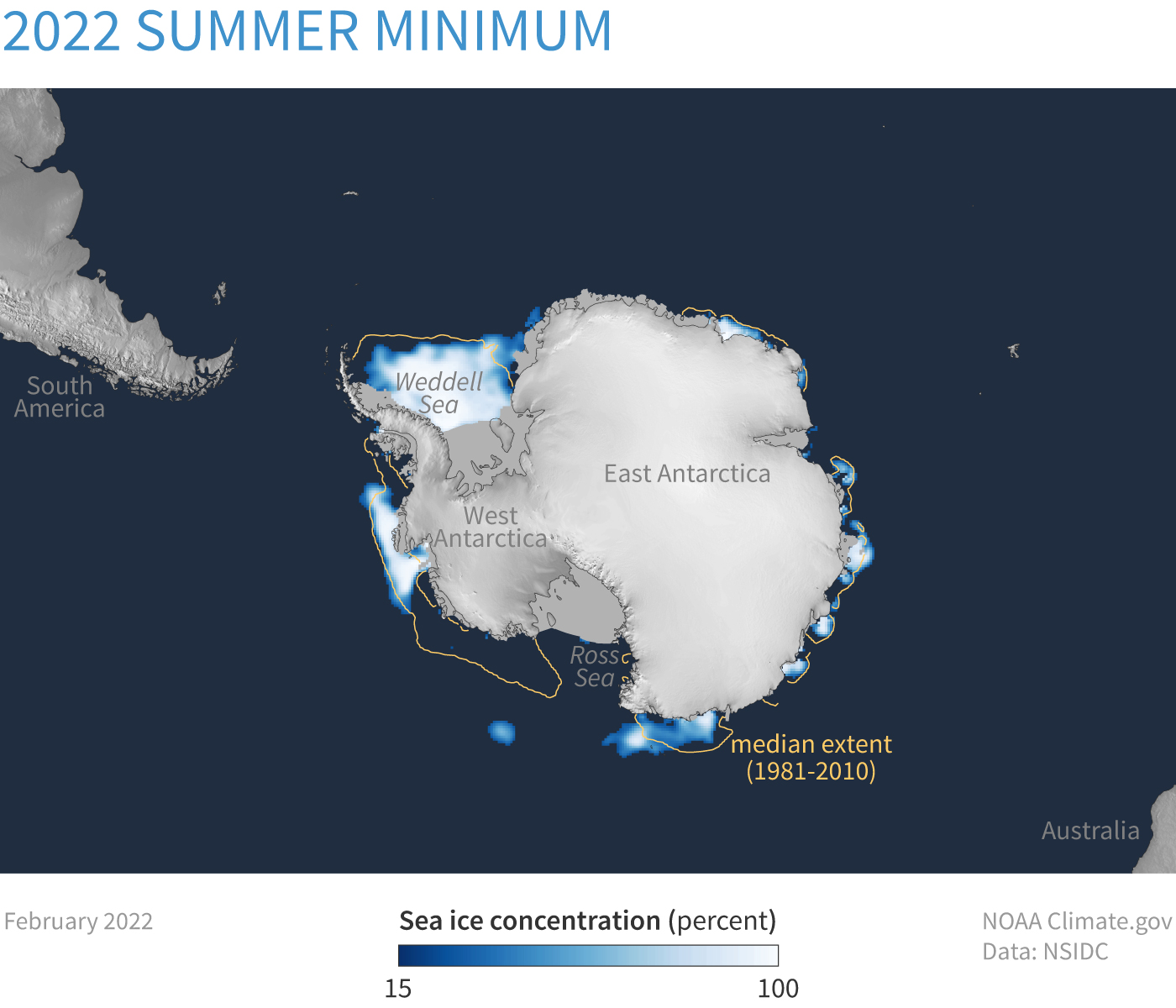
Average Antarctic sea ice concentration in February 2022, the month when sea ice reaches its summer minimum extent. Compared to median conditions from 1981-2010 (yellow line), the most recent minimum was below average. Map by NOAA Climate.gov, based on satellite data provided by National Snow and Ice Data Center.