Tools & Interactives
Interactive map of the hottest maximum temperatures at locations and when that record was set, recorded at thousands of U.S. stations.
View this tool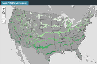
Interactive map showing the average annual coldest winter temperatures across the contiguous U.S. divided into 10-degree "planting zone" bins for 1971-2000, 1981-2010, and the shift between the two.
View this tool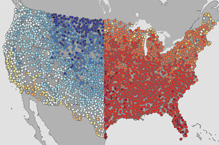
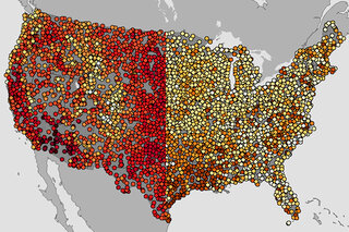
To highlight spring’s extremes, here are maps of the warmest and coolest first day of spring (March 19) recorded at thousands of U.S. weather stations during each station’s history.
View this tool