
It's been a tough year for the globe's coral and the scientists who use coral to paint a picture of ENSO back thousands of years.

The 2015-2016 El Niño will go down as one of the strongest on record, and also, thanks to El Niño Rapid Response Campaign, one of the best observed.
Where are my El Niño impacts?!
Was El Niño to blame for the above-average temperatures during November and December 2015? As always, the answer is not that simple.
El Niño is a global phenomenon. Guest blogger Dr. Andrew Watkins shines some light on El Niño's impact across the world in Australia.
“El Niño is Strong!” “No, it’s Moderate!” “But the [insert your favorite ENSO indicator here] is the largest it’s been since the El Niño of 1997-98!”
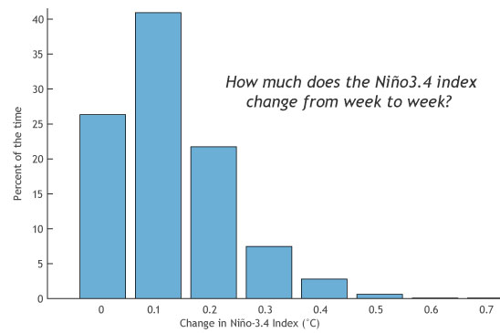
Why is it so difficult to make a good ENSO prediction during the Northern Hemisphere spring?
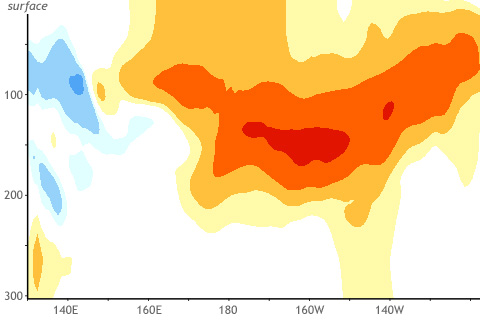
You're not the only one wondering if we will see El Niño grow or continue into this coming winter 2015. How useful are March winds and subsurface temperatures across the tropical Pacific Ocean in predicting winter El Niño or La Niña states?
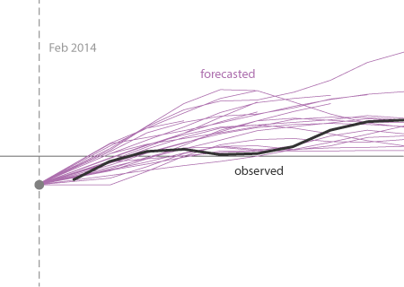
The model predictions during 2014 were not that shabby. A major, strong El Niño was not well justified by the predictions.
How El Niño is like different flavors of ice cream. Seriously.