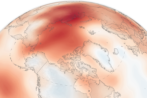
The 15th installment of NOAA's Arctic Report Card NOAA's 15th Arctic Report Card catalogs the numerous ways that climate change continues to disrupt the polar region.
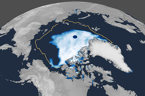
Arctic sea ice extent likely reached its annual minimum for 2020 on September 15. For the second time in the satellite record, sea ice extent dipped below 1.5 million square miles (4 million square kilometers).
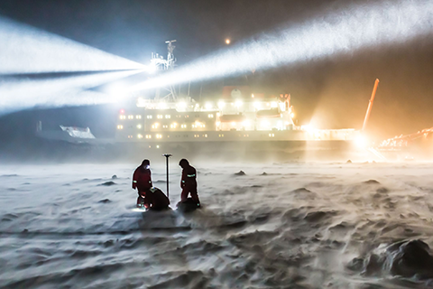
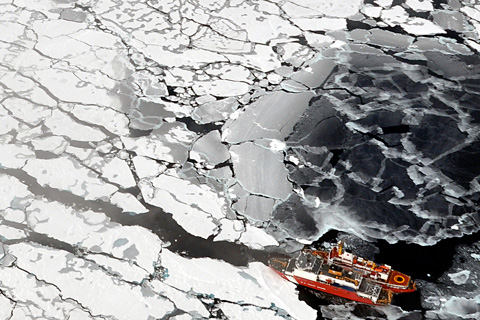
In 2015, NOAA's Climate Program Office (CPO) invited grant proposals from sea ice and climate scientists looking to better understand and predict Arctic sea ice behavior, on timescales ranging from days to decades. This is our second story on some of the resulting research.
Arctic sea ice extent reached its apparent annual maximum on March 5, 2020. It was the 11th-lowest maximum in the 42-year satellite record. Though nowhere near a record low, it was well below the 1981–2010 average.
NOAA’s 14th Arctic Report Card recounts the numerous ways that climate change continues to disrupt the polar region, including massive melt of the Greenland ice sheet and major shifts in the distribution of commercially valuable marine species.
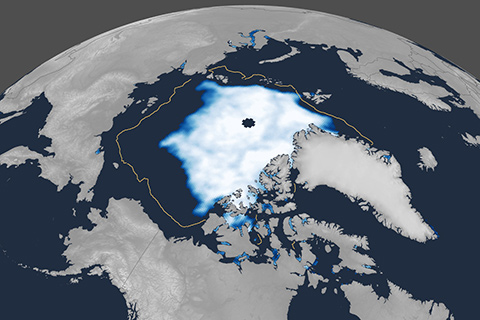
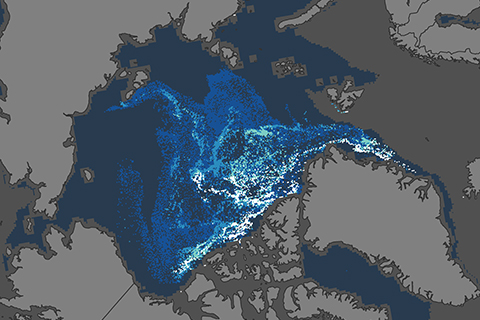
In 2019, the area of the Arctic Ocean where the summer sea ice cover was at least 15 percent tied with 2007 and 2016 as the second-smallest on record.
Antarctic sea ice extent hit a record low extent in February, but thanks to large natural variability from year to year, experts say there is still no long-term trend.
From declining reindeer populations to a younger, thinner ice pack, here are four image-based stories from the 2018 Arctic Report Card.
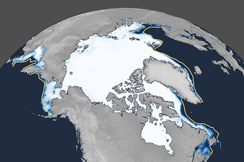
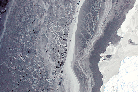
Unlike the rest of us, Arctic sea ice is younger and thinner than it was in the mid-1980s.
NOAA scientists have released the 2017 Arctic Report Card: the complete guide to climate conditions in the planet's Far North.