
Image caption
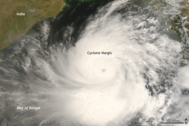
NASA TERRA/MODIS satellite image taken on May 1, 2008 of Cyclone Nargis in the Bay of Bengal. Cyclone Nargis made landfall in Myanmar on May 2 killing an estimated 138,000 people. NOAA Climate.gov image with data provided from NASA.
NASA TERRA/MODIS satellite image taken on May 1, 2008 of Cyclone Nargis in the Bay of Bengal. Cyclone Nargis made landfall in Myanmar on May 2 killing an estimated 138,000 people. NOAA Climate.gov image with data provided from NASA.