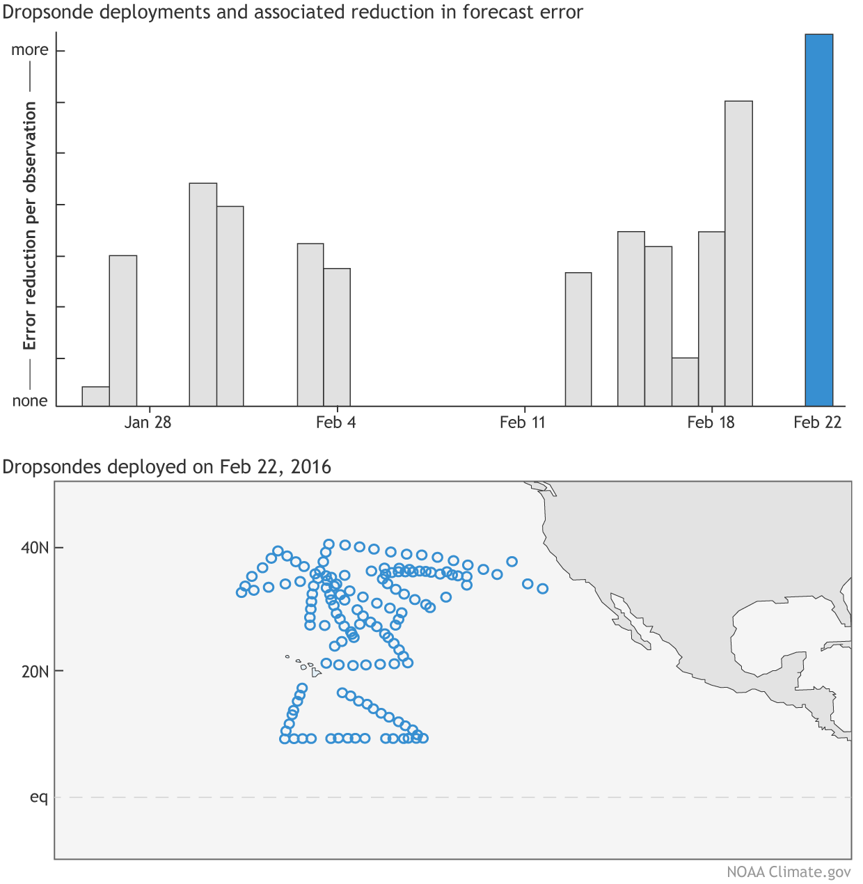
(Top) Impact of dropsondes on the 24-hr forecast error of moist total energy in NASA'S GEOS-5 model. The error in moist total energy takes into account errors in wind, temperature, specific humidity and surface pressure. (Bottom) Location of the dropsondes released on February 22, 2016, by the NOAA Gulfstream aircraft and additional aircraft aiding in the research campaign including the unmanned drone, the Global Hawk. The release of dropsondes during the El Nino Rapid Response Campaign helped to reduce forecast errors by reducing errors in the sparsely observed tropical eastern Pacific Ocean. Bar graph data is courtesy of NASA and the dropsonde plot is courtesy of the Environmental Modeling Center within the National Center for Environmental Prediction. Figure is adapted from original provided by Amy Solomon.