File name: lake_erie_precip_610.jpg
Original Resolution: 610 × 708
File Size: 176 KB (MIME Type: image/jpeg)
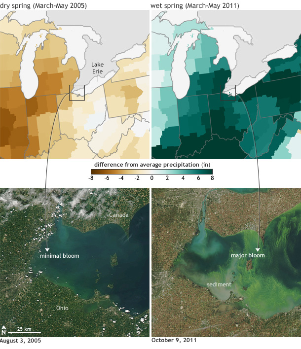
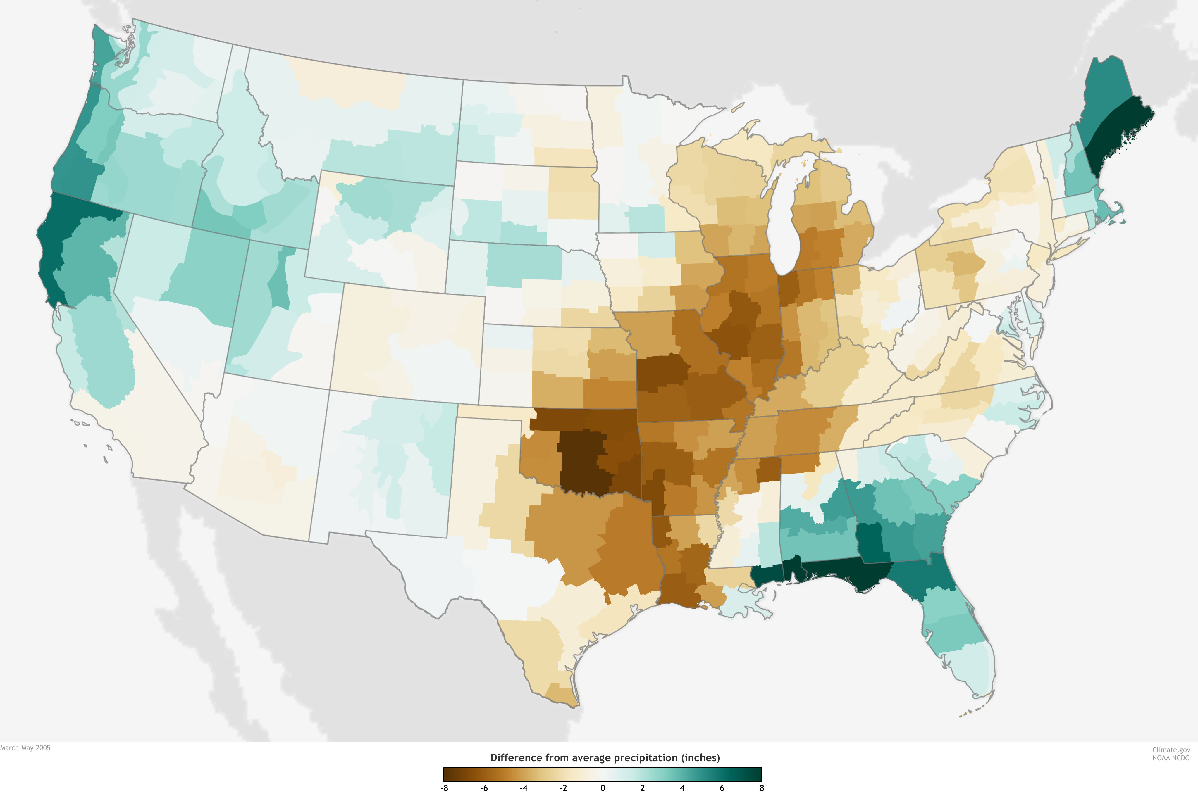
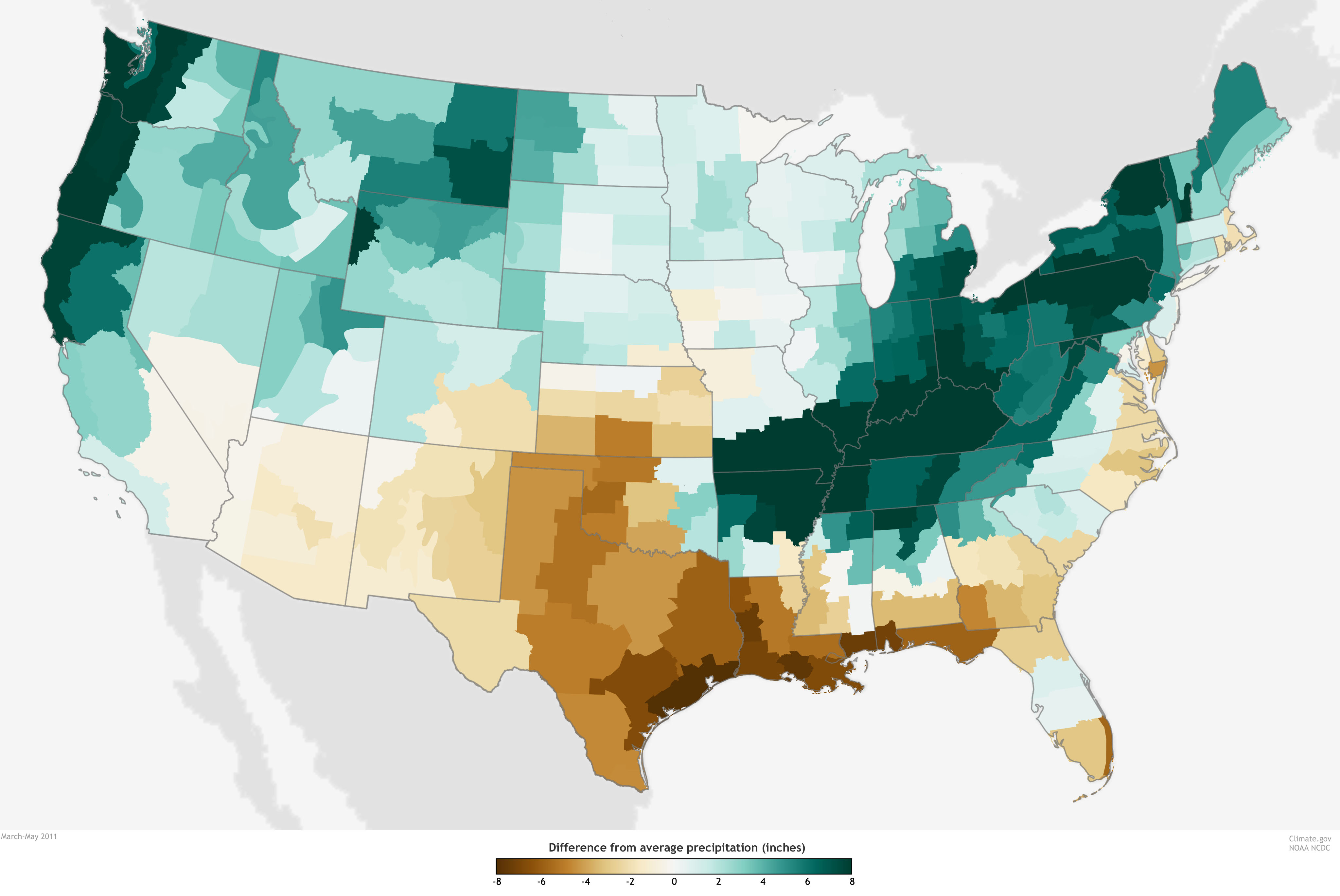
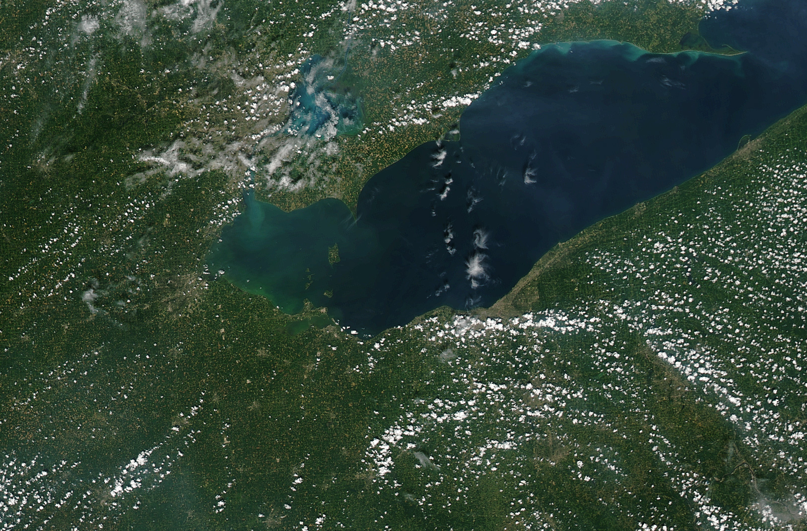
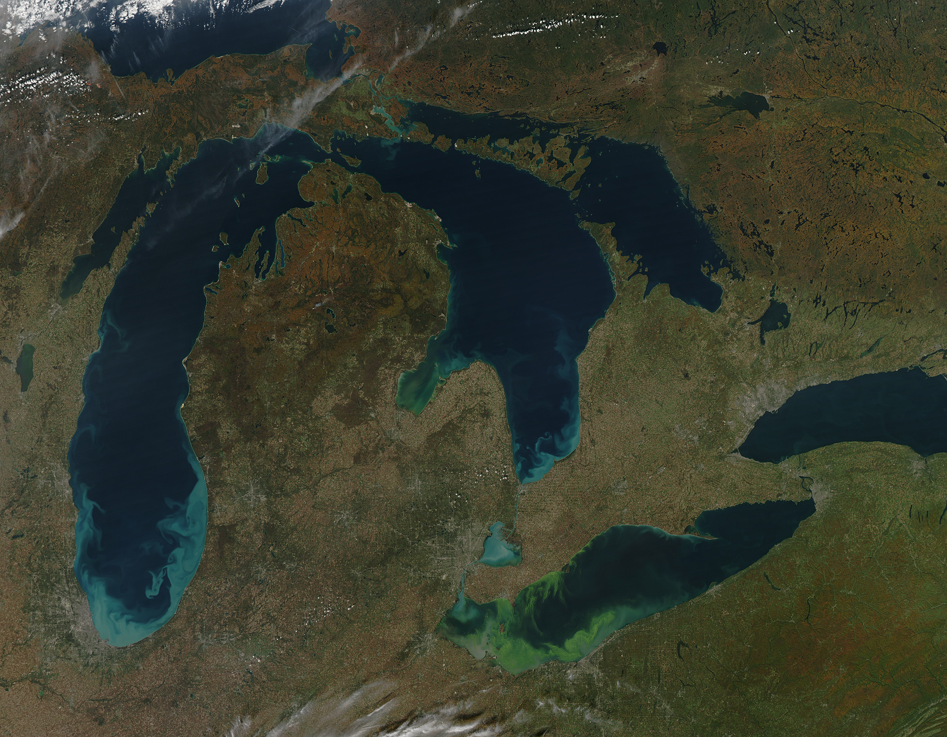
(Top row) Difference from average precipitation for a dry spring (March-May 2005,) and a wet spring (March-May 2011). (Bottom row) NASA satellite image of the western end of Lake Erie in the respective summer/fall. The bloom was minimal in 2005 (left), but dramatic in 2011 (right). large versions: precip 2005 | precip 2011| satellite 2005 | satellite 2011