File name: US_extremes_index_jan-jul2014_610.gif
Original Resolution: 610 × 295
File Size: 33 KB (MIME Type: image/gif)
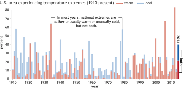
Graph of percent U.S. area affected by extremes in maximum temperature (red is warm, blue is cool) in January-July 2014, based on data from the U.S. Climate Extremes Index (Step 1) from the National Climatic Data Center.