File name: SnowDepth-5-2014_610.jpg
Original Resolution: 610 × 470
File Size: 197 KB (MIME Type: image/jpeg)
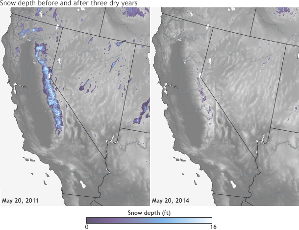
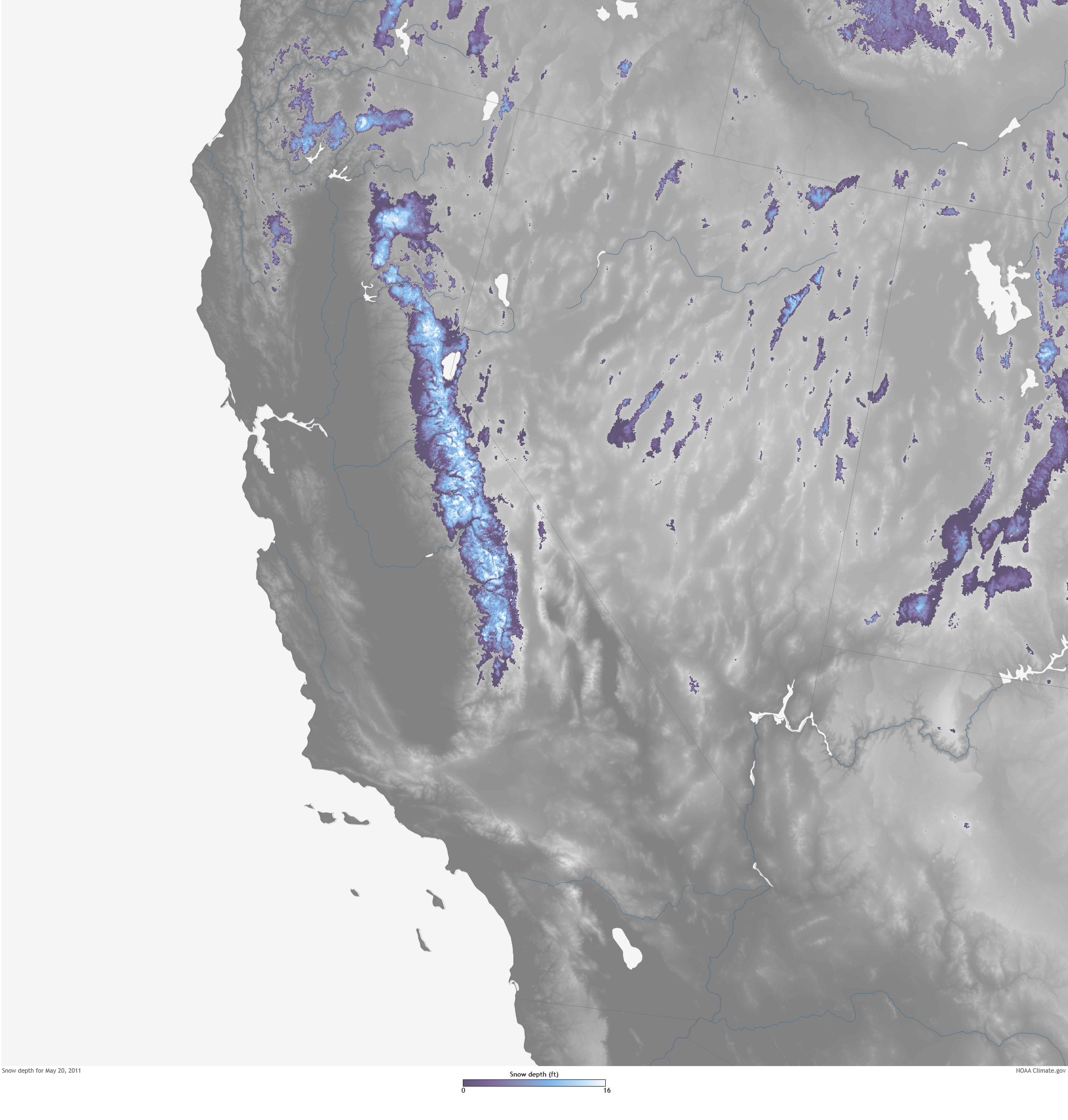
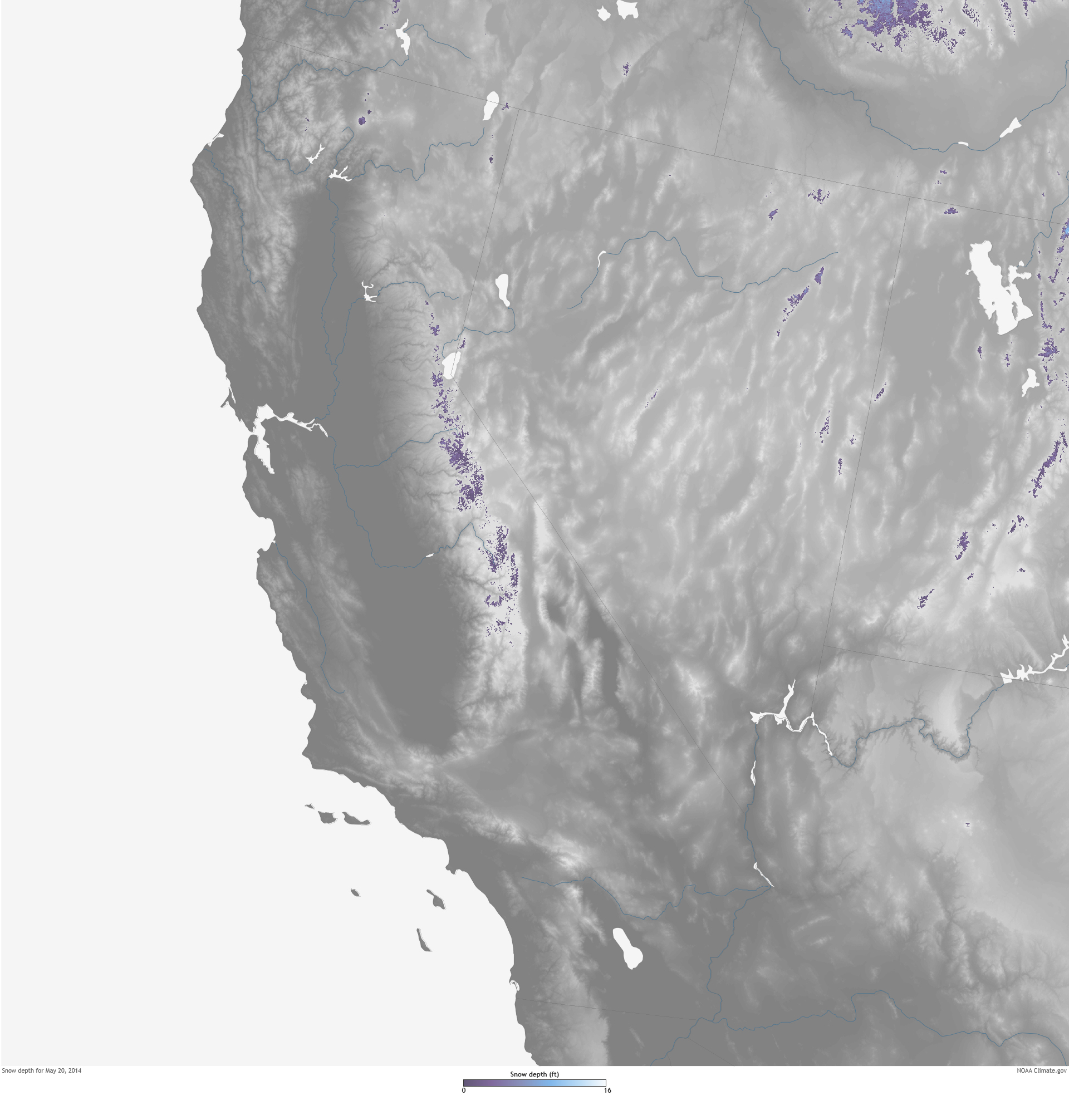
The maps show snow depth as of May 20, 2011, and after three consecutive dry years on May 20, 2014. Deep snow is pale blue or white, and trace amounts are dark purple. Snow-free land is gray, and rivers and lakes are blue. Maps by NOAA Climate.gov, based on modeled snow depth data from the NOAA National Weather Service's National Operational Hydrologic Remote Sensing Center (NOHRSC) Snow Data Assimilation System (SNODAS).
large snow depth 5-2011 image | large snow depth 5-2014 image