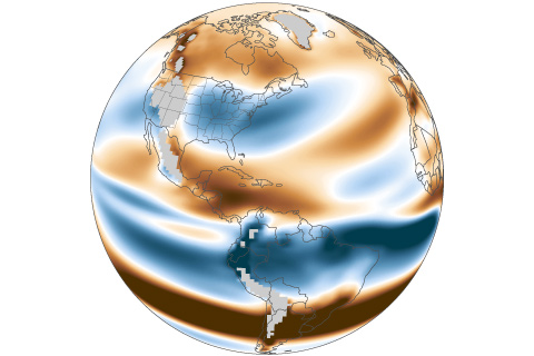
During active hurricane eras, a persistent zone of high vertical wind shear along the U.S. East Coast provides protection from rapidly intensifying hurricanes. With high emissions, that shear is projected to relax.
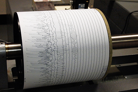
NOAA-funded researchers have developed a way to estimate hurricane strength using nothing but seismic data used to track earthquakes and volcanoes. The technique may help expand the pre-satellite record of tropical cyclone activity.
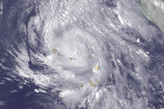
Wait, a hurricane formed where in the Atlantic?
September 3, 2015
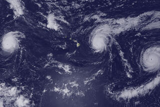
Central Pacific hurricane party: three’s company
September 3, 2015

Maps of the thousands of storms that have passed through the Eastern Hemisphere tropical oceans in the past century or so reveal a more crowded landscape than similar maps of the Western Hemisphere. Unlike the Western Hemisphere, where storms are mostly confined to areas north of the equator, the Eastern Hemisphere sees storms in both north and south tropical waters.
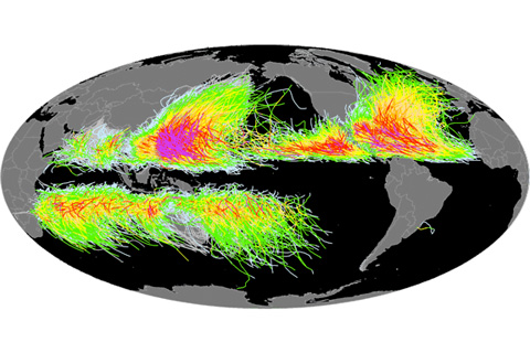
Researchers at NOAA’s National Climatic Data Center collaborate with tropical cyclone centers and scientific agencies around the world to assemble and maintain the International Best Track Archive for Climate Stewardship (IBTrACS), an inventory of tropical cyclones.